Frederick Coburn Bridge (Richmond)
Canada /
Quebec /
Richmond /
ROUTE 116, 143, 243
World
/ Canada
/ Quebec
/ Richmond
World / Canada / Québec / Le Val-Saint-François
bridge
Add category


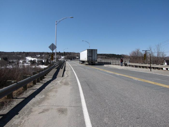


The Frederic-Coburn bridge, on the St. Francois River is located in Richmond, QC. This bridge is situated about halfway between Sherbrooke and Drummondville, and was built between 1965 and '66 to allow Highways 116 and 143 to cross the St. Francois. Known longtime by the name 'The New Bridge', it was officially named in 2009, in honour of Frederick Coburn, a Quebecan painter.
Nearby cities:
Coordinates: 45°39'55"N 72°9'6"W
- Laviolette Bridge 79 km
- Railway Bridge 134 km
- Canadian National Railway (CN) Trestle Bridge 136 km
- Pierre-Laporte Bridge 138 km
- Québec Bridge 138 km
- Pont Mékinak 151 km
- Île d'Orléans Bridge 156 km
- Abandoned Trestle Over Allagash Stream 224 km
- Clair, New Brunswick - Fort Kent, Maine border crossing 324 km
- Saint-Léonard, New Brunswick - Van Buren, Maine border crossing (Bridge) 364 km
- Doré Brook 0.9 km
- Trudo Group Inc. 1.1 km
- TERRAIN 1.3 km
- St-Francis Elementary School 1.7 km
- Richmond Regional High School 1.9 km
- Richmond Logistique, Groupe TYT 2.3 km
- Exit no 85 of Autoroute 55 3.3 km
- Crackholm Holsteins - Farm 3.4 km
- JARDINS CHANT DE VIE 7.5 km
- Spooner Pond 8.2 km