Paiute Wilderness
USA /
Nevada /
Mesquite /
World
/ USA
/ Nevada
/ Mesquite
World / United States / Arizona
park, nature conservation park / area
Wikimapia did not let me make this as big as it actually is on my first effort. The area stretches from the Utah border south to Grand Canyon Parashant National Monument.
www.publiclands.org/explore/site.php?plicstate=AZ&id=54...
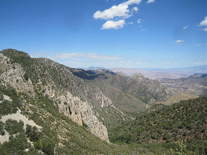
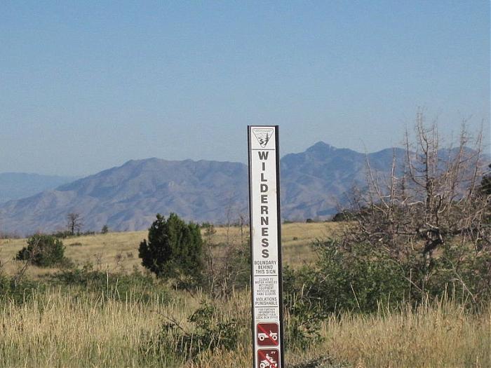
Description: The 87,900-acre Paiute Wilderness, several miles southwest of St. George, Utah, dominates the northwest portion of the Arizona Strip. It is separated from the Beaver Dam Mountains Wilderness to the north by Interstate 15. The Virgin Mountains form the backbone of this area rising over 5,600 feet from the desert floor. Mt. Bangs, the highest peak in the area at 8,012 feet, provides a commanding view of the area and the Basin and Range country to the west. The area's vegetation varies, ranging from ponderosa on top of Mt. Bangs, through pinyon forests, to scrub oak and sagebrush, and at the area's perimeter, Joshua trees, yucca and barrel cactus. These ecotypes host over 250 animal species including mule deer, mountain lion, desert bighorn sheep and desert tortoise. The deep canyons have several beautiful and secret places with water which attract campers and backpackers.
Location: From St. George, Utah, travel I-15 toward Nevada to Cedar Pockets rest area/ Virgin River Gorge Campground. The wilderness lies south of I-15 and the Virgin River.
www.publiclands.org/explore/site.php?plicstate=AZ&id=54...
Description: The 87,900-acre Paiute Wilderness, several miles southwest of St. George, Utah, dominates the northwest portion of the Arizona Strip. It is separated from the Beaver Dam Mountains Wilderness to the north by Interstate 15. The Virgin Mountains form the backbone of this area rising over 5,600 feet from the desert floor. Mt. Bangs, the highest peak in the area at 8,012 feet, provides a commanding view of the area and the Basin and Range country to the west. The area's vegetation varies, ranging from ponderosa on top of Mt. Bangs, through pinyon forests, to scrub oak and sagebrush, and at the area's perimeter, Joshua trees, yucca and barrel cactus. These ecotypes host over 250 animal species including mule deer, mountain lion, desert bighorn sheep and desert tortoise. The deep canyons have several beautiful and secret places with water which attract campers and backpackers.
Location: From St. George, Utah, travel I-15 toward Nevada to Cedar Pockets rest area/ Virgin River Gorge Campground. The wilderness lies south of I-15 and the Virgin River.
Wikipedia article: http://en.wikipedia.org/wiki/Paiute_Wilderness
Nearby cities:
Coordinates: 36°50'27"N 113°48'59"W
- Snow Canyon State Park 49 km
- Beaver Dam Wash National Conservation Area 50 km
- Zion National Park 91 km
- Wayne E. Kirch Wildlife Management Area 216 km
- Great Basin National Park 256 km
- The Wall Wilderness Area 264 km
- Grapevine Mountain Wilderness Study Area 311 km
- Queer Mountain Wilderness Study Area 330 km
- Silver PEAK Wilderness Study Area 387 km
- Ruby Lake National Wildlife Refuge 412 km
- Mount Bangs 6.4 km
- Black Rock Mountain 7.7 km
- Littlefield, Arizona 11 km
- Rainwater Harvesting. 17 km
- Rainwater Harvesting. 17 km
- Rainwater Harvesting. 18 km
- Cistern 19 km
- Wolf Hole Mountain 19 km
- Wolf Hole, Arizona 26 km
- Rainwater Harvesting. 27 km