Mouth of Mayurakshi river
India /
Jharkhand /
Dumka /
Massanjore
World
/ India
/ Jharkhand
/ Dumka
World / India / Jharkhand / Dumka
river, estuary
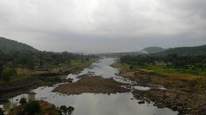
Mayurakshi River (also called Mor River) is a major river in West Bengal, India, with a long history of devastating floods.
It has its source on Trikut hill, about 16 km from Deoghar in Jharkhand state.[1] It flows through Jharkhand and then through the districts of Birbhum and Murshidabad in West Bengal before flowing into the Hooghly River. The river is about 250 km long.
It has its source on Trikut hill, about 16 km from Deoghar in Jharkhand state.[1] It flows through Jharkhand and then through the districts of Birbhum and Murshidabad in West Bengal before flowing into the Hooghly River. The river is about 250 km long.
Wikipedia article: http://en.wikipedia.org/wiki/Mayurakshi_River
Nearby cities:
Coordinates: 24°6'14"N 87°18'36"E
- Haldi River Mouth 234 km
- Vasai Creek / Bassein Creek 1591 km
- Kori Creek 1927 km
- Sir Creek 1944 km
- Kajar Creek 1963 km
- Pachar Creek 1980 km
- Khoshk Rood River & vally 2973 km
- sabri River 3210 km
- Dalaki River &River delta 3667 km
- Khawr Abd Allah estuary 3928 km
- Picnic spot 0.2 km
- Massanjore Dam 0.3 km
- Recreation park 0.3 km
- Massanjore coloney 0.8 km
- Bandh 3 km
- Hills of Sadipur 6 km
- Masanjore Dam Reservoir 6.2 km
- Laal Baba Ashram 6.5 km
- hathiyapathar,dumka 8.7 km
- Bermashiya 15 km
Comments