Kolpino
Russia /
Sankt Petersburg /
Kolpino /
World
/ Russia
/ Sankt Petersburg
/ Kolpino
, 4 km from center (Колпино)
World / Russia / Leningrad
city, invisible, draw only border, third-level administrative division, City of Military Glory - Russian honorary title
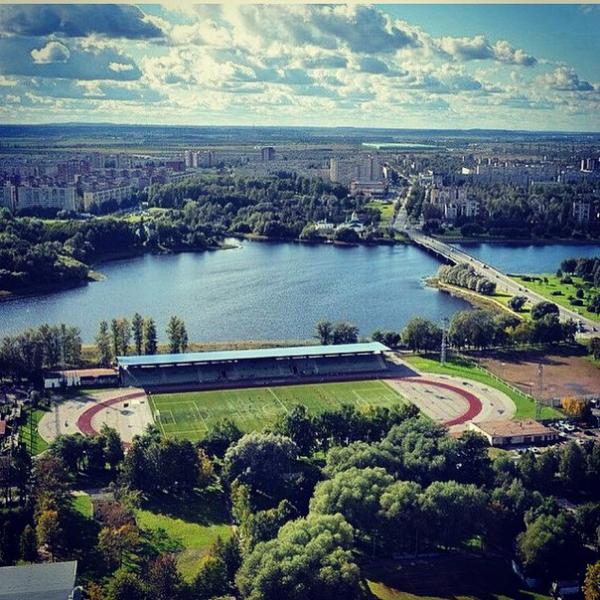
Municipal city in Kolpinsky District of the federal city of St. Petersburg, Russia, located on the Izhora River (tributary of the Neva) 26 kilometers (16 mi) southeast of St. Petersburg proper. Population: 138,979 (2010 Census).
Kolpino was founded in 1722 and was granted town status in 1912. It was one of the chief ironworks of the crown in Russia. Kolpino was also home to an iron foundry of the Russian Admiralty. A sacred image of St. Nicholas in the Trinity Church is visited by numerous pilgrims on May 22 every year. With the onset of World War II, Kolpino factory workers formed the Izhora Battalion, part of the militia, August 24 – September 4, 1941. The front line was held in the immediate vicinity of the plant, which was subjected to heavy enemy shelling. By 1944, only 327 of Kolpino's 2183 houses remained intact. 140,939 shells and 436 aerial bombs had fallen in Kolpino's neighborhoods and streets. According to incomplete data for the war, shelling and starvation in the Kolpino district killed 4,600 people, not counting the dead on the front. By January 1, 1944 Kolpino had only 2196 inhabitants. After the lifting of the siege, people gradually came back from the evacuation and from the army. On January 1, 1945 population was 7404, the beginning of next year – 8914 people.
Kolpino was founded in 1722 and was granted town status in 1912. It was one of the chief ironworks of the crown in Russia. Kolpino was also home to an iron foundry of the Russian Admiralty. A sacred image of St. Nicholas in the Trinity Church is visited by numerous pilgrims on May 22 every year. With the onset of World War II, Kolpino factory workers formed the Izhora Battalion, part of the militia, August 24 – September 4, 1941. The front line was held in the immediate vicinity of the plant, which was subjected to heavy enemy shelling. By 1944, only 327 of Kolpino's 2183 houses remained intact. 140,939 shells and 436 aerial bombs had fallen in Kolpino's neighborhoods and streets. According to incomplete data for the war, shelling and starvation in the Kolpino district killed 4,600 people, not counting the dead on the front. By January 1, 1944 Kolpino had only 2196 inhabitants. After the lifting of the siege, people gradually came back from the evacuation and from the army. On January 1, 1945 population was 7404, the beginning of next year – 8914 people.
Wikipedia article: http://en.wikipedia.org/wiki/Kolpino
Nearby cities:
Coordinates: 59°45'37"N 30°37'57"E
- Kuyvozovskoye rural settlement 92 km
- Yadrovskaya volost 255 km
- 1 284 km
- Lavry volost (district) 301 km
- Asviejski Selsoviet 433 km
- Rokiškis rural eldership 509 km
- Parovėja eldership 513 km
- Širvėna eldership 523 km
- Kupiškis eldership 548 km
- Šiauliai rural eldership 605 km
- Voznesenskoye shosse, 55 0.1 km
- Voznesenskoye shosse, 53 0.1 km
- Yuzhnaya ulitsa, 3 2.2 km
- Yuzhnaya ulitsa, 7 2.2 km
- Pontonny 2.2 km
- Yuzhnaya ulitsa, 1 корпус 1 2.3 km
- Yuzhnaya ulitsa, 1 корпус 2 2.4 km
- Kolpinsky District 2.7 km
- Sapyornaya railway station 3 km
- Sapyorny 4.3 km