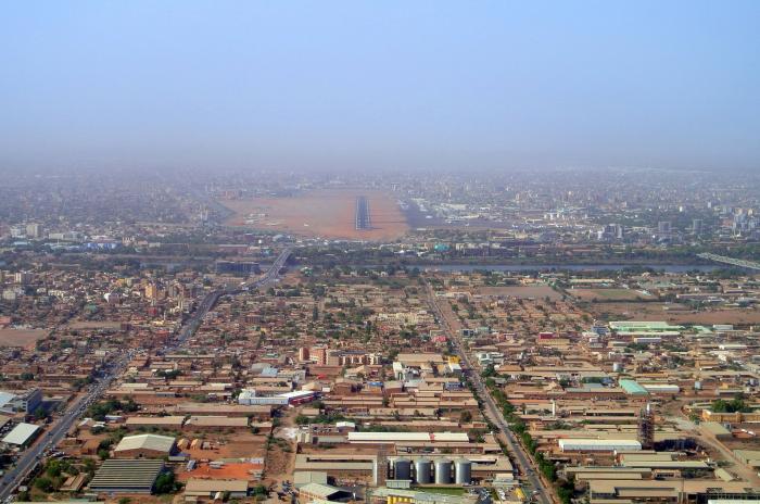
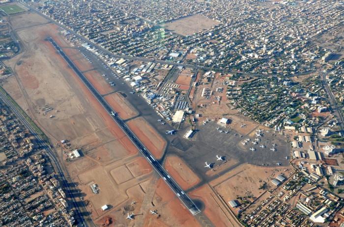
Khartoum International Airport (Khartoum)
Sudan /
Khartum /
Khartoum
World
/ Sudan
/ Khartum
/ Khartoum
, 4 km from center (الخرطوم)
World / Sudan / Khartoum / Khartoum / Khartoum
airport, international airport


Known properly as KRT Civil Airport, Khartoum, Sudan
Latitude / Longitude:
15.592217 / 32.549698
Time Zone: +3:00 hours from UTC/GMT
Airport Code:
FlightStats code: KRT
IATA code: KRT
ICAO code: HSSS
FAA code:
It will be replaced with a new airport 40 kilometers south of the centre of Khartoum by 2010.
Latitude / Longitude:
15.592217 / 32.549698
Time Zone: +3:00 hours from UTC/GMT
Airport Code:
FlightStats code: KRT
IATA code: KRT
ICAO code: HSSS
FAA code:
It will be replaced with a new airport 40 kilometers south of the centre of Khartoum by 2010.
Wikipedia article: http://en.wikipedia.org/wiki/Khartoum_International_Airport
Nearby cities:
Coordinates: 15°35'24"N 32°33'4"E
- King Abdulaziz International Airport 973 km
- Capital International Airport 1617 km
- Sphinx International Airport 1630 km
- King Khalid International Airport (IATA: RUH, ICAO: OERK) 1801 km
- Isfahan International Airport 2729 km
- Istanbul Airport 2889 km
- Frankfurt Airport (IATA: FRA / ICAO: EDDF) 4406 km
- Paris Charles de Gaulle Airport / Aéroport Roissy (CDG/LFPG) 4614 km
- Amsterdam Airport Schiphol (IATA: AMS, ICAO: EHAM) 4772 km
- Novosibirsk Tolmachevo International Airport 6114 km
- Khartoum 2 1.3 km
- Airport district 1.5 km
- Imtidad Nasir 1.7 km
- Al Amarat 1.8 km
- MIlitary Area 1.9 km
- Al-Khartoum Wasat 2.1 km
- Al Riyad 2.2 km
- Buri Addaraysa 2.2 km
- Al Barari 2.5 km
- Khartoum 1 3.4 km
Comments