Sundarbans
Bangladesh /
Bagar Hat /
Mungla /
World
/ Bangladesh
/ Bagar Hat
/ Mungla
Mondo / India / Bengala Occidentale / Distretto dei 24 Pargana Nord
foresta, palude, mangrove (en), Luogo del patrimonio mondiale UNESCO, wildlife protection/conservation (en), bird sanctuary (en)


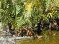

La più estesa foresta di mangrovie al mondo.
Patrimonio dell' umanità dal 1997
Patrimonio dell' umanità dal 1997
Articolo Wikipedia: http://it.wikipedia.org/wiki/Sundarbans
Nearby cities:
Coordinate: 22°1'0"N 89°9'34"E