Xitle volcano
Mexico /
Zacamulpa /
World
/ Mexico
/ Mexico
/ Zacamulpa
World / Mexico / Distrito Federal
mountain, volcano
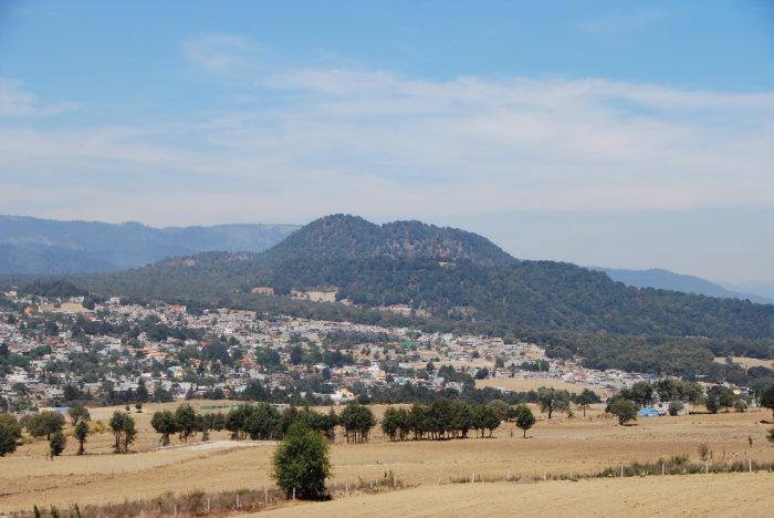
Small volcano. It last erupted in 400 A.C. completely covering with lava the Cuicuilco City-state, except for the tallest, "round" pyramid still visible about 4.5 miles northeast.
Wikipedia article: http://en.wikipedia.org/wiki/Xitle
Nearby cities:
Coordinates: 19°14'47"N 99°13'19"W
- Parque Lagunas de Zempoala 22 km
- Sierra de Guadalupe Natural Park 42 km
- Popocatepetl Volcano 57 km
- Iztaccihuatl Volcano 58 km
- Nevado de Toluca National Park 73 km
- La Malinche National Park 111 km
- Pico de Orizaba 202 km
- Вулкан Кофре-де-Пироте 213 km
- La Gavia Mountain 224 km
- Tequila Volcano 519 km
- Cuautzontle Volcano 1.3 km
- escuela jose maria chavez andrade 2.7 km
- Ajusco 2.8 km
- Vocational Center of the Legionaries of Christ 2.9 km
- San Miguel Ajusco 3.4 km
- Magdalena Petlacalco 4.7 km
- Magdalena Contreras borough 5 km
- Tlalpan borough 5.6 km
- Alvaro Obregon borough 8.4 km
- Greater Mexico City 25 km