Gjirokastër District
Albania /
Gjirokaster /
World
/ Albania
/ Gjirokaster
/ Gjirokaster
World / Albania / Gjirokastër / Gjirokastrës
district, second-level administrative division, draw only border
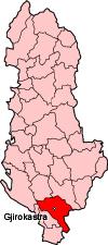
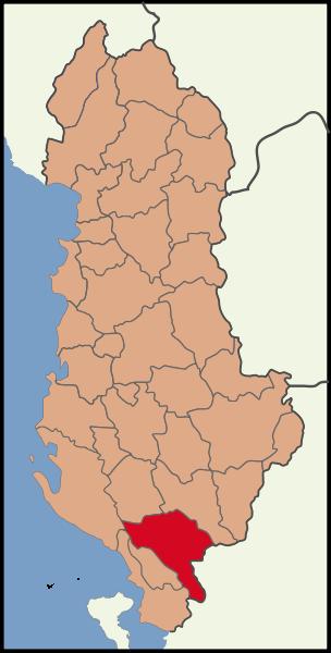
The District of Gjirokastër (Albanian: Rrethi i Gjirokastrës) is one of the thirty-six districts of Albania. It has a population of 56,720 (2010 estimate) containing a large Greek minority, and an area of 1,137 km².
It is in the south of the country, and its capital is Gjirokastër. Together with the Përmet District and the Tepelenë District, it forms the Gjirokastër County.
The district consists of the following municipalities:
* Antigonë
* Cepo
* Dropull i Poshtëm
* Dropull i Sipërm
* Gjirokastër
* Lazarat
* Libohovë
* Lunxhëri
* Odrie
* Picar
* Pogon
* Qendër Libohovë
* Zagori.
Wikipedia article: http://en.wikipedia.org/wiki/Gjirokastër_District
Nearby cities:
Coordinates: 40°0'34"N 20°10'28"E
- Sarandë District 32 km
- Përmet District 53 km
- Tepelenë District 65 km
- Skrapar District 79 km
- Berat District 96 km
- Korçë District 104 km
- Vlorë District 105 km
- Pogradec District 122 km
- Fier District 125 km
- Lushnjë District 133 km
- Mount Nikollaqit (1598 m) 4.4 km
- Mali i Gjerë 5 km
- Dropull i Poshtëm 5.5 km
- Park 8.7 km
- Muzina Pass 8.8 km
- Mount Kostar (556 m) 10 km
- Rrezoma Reserve 11 km
- Koqinolithar Mountain 12 km
- Mesopotam Administrative Unit 12 km
- Finiq Administrative Unit 17 km
Comments