Gumla
India /
Jharkhand /
Gumla /
National Highway 78 (Katni-Gumla)
World
/ India
/ Jharkhand
/ Gumla
World / India / Jharkhand / Gumla
city, taluka headquarter, district headquarter
Anchal Gumla, Jila Gumla, Jharkhand.
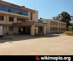
Gumla is a Nagar Panchayat city in district of Gumla, Jharkhand.
The Gumla Nagar Panchayat has population of 51,264 as per report released by Census India 2011.
During British rule GUMLA was under LOHARDAGA district .In 1843 it was brought under BISHUNPUR province that was further named RANCHI .In fact Ranchi district came into existence in 1899. In 1902 Gumla became Sub-division under Ranchi district. Blessed with nature’s beauty , the district of Gumla is covered by dense forests, hills and rivers. It is situated in the southwest portion of the Jharkhand State. The District was carved out of Ranchi District on 18th May 1983.
Wikipedia article: http://en.wikipedia.org/wiki/Gumla
Nearby cities:
Coordinates: 23°2'42"N 84°32'53"E
- Ranchi 83 km
- Jamshedpur 155 km
- Bokaro Steel City 167 km
- Dhanbad 207 km
- Durgapur 280 km
- Kharagpur 282 km
- Patna 294 km
- Kolkata 382 km
- Khulna 505 km
- Siliguri 563 km
- Murkunda 15 km
- Telanga Chattan (Baghima-Ambatoli) 17 km
- Jatra Tongri (Baghima-Ambatoli) 17 km
- Masaria Dam Reservoir 19 km
- Kaliga 19 km
- Mani Pahar 19 km
- Banki Dam Reservoir 20 km
- Kutuwa 20 km
- Jharkhand-Chattisgarh Border 20 km
- BARGAON 21 km
Comments