Mali i Thatë (2287 m)
Albania /
Pogradec /
World
/ Albania
/ Pogradec
/ Pogradec
World / Albania / Korçë / Korçës
mountain, invisible


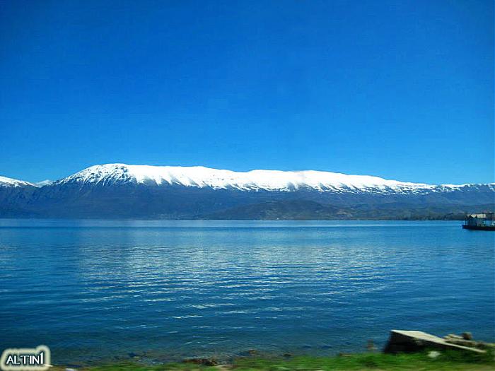
Mali i Thatë (Dry Mountain) is a mountain in southeast Albania and a part of it being in southwest of Macedonia (known with the name Galičica and declared a National Park) with the highest altitude of 2287 meters. It stretches 25 km from north to south and is 8 km wide in its central part. It borders Lake Prespa in the east, Lake Ohrid in northwest and overlooks the city of Pogradec to the west. Mali i Thatë highest peak is Pllaja e Pusit (meanaing "Well's plateau")and it reaches an altitude of 2,287 m (7,503 ft) above sea level, found within Albania, close to the Macedonian border and from this high peak, among several mountains of Albania, both Ohrid Lake and Prespa Lake can be seen, as well as the third highest peak in the Republic of Macedonia, Baba Mountain or Pelister Mountain (2601 m). The second highest peak is Magaro (2254m = 7395 ft), found within Macedonia, in the southernmost part of Galičica National Park and is the most popular hiking destination of it. Both of the peaks offer a spectacular natural scenery. "Dry Mountain" has an anticlinal shape and is almost completely composed of mesozoic limestone formations. The mountain has craggy slopes (especially the western face), whereas its crest is almost flat but full of carstic cavities. As its name suggests, it is very poor of vegetation which is mostly made up of alpine meadows, whereas in the eastern face towards Great Prespa lake beech, oak and bush forests are found.
Pic. 1: Hiking to the top of Dry Mountain in April 2010
Pic. 2: View of Mount Pelister in Macedonia, from the highest peak Pllaja e Pusit 2287m.
Pic. 3: View from the summit towards Mount Ivan in the south in November 2009.
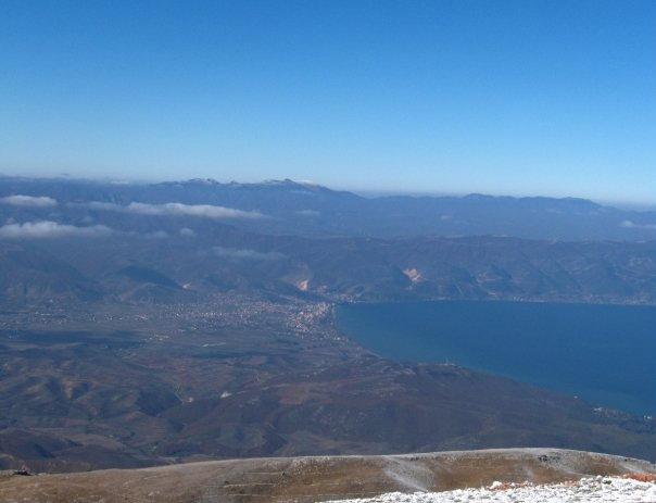
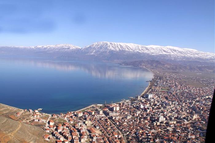
Pic. 4: Pogradec city as seen from the top of Dry Mountain (Mali i Thatë).
Pic. 1: Hiking to the top of Dry Mountain in April 2010
Pic. 2: View of Mount Pelister in Macedonia, from the highest peak Pllaja e Pusit 2287m.
Pic. 3: View from the summit towards Mount Ivan in the south in November 2009.
Pic. 4: Pogradec city as seen from the top of Dry Mountain (Mali i Thatë).
Wikipedia article: http://en.wikipedia.org/wiki/Mali_i_Thatë
Nearby cities:
Coordinates: 40°49'6"N 20°50'45"E
- Baba Mountain 33 km
- Nidzhe / Voras Mt. 71 km
- Mount Vermio 77 km
- Mount Lunxhëri 88 km
- Mali i Gjerë 103 km
- Kamvounia Mts 103 km
- Pierian Mountains 108 km
- Mountain Mitsikeli 108 km
- Mount Olympus 125 km
- Αthamanika Mountains (Tzoumerka) 134 km
- Pustec Plain 5.7 km
- Municipality of Pustec 6.5 km
- Administrative unit of Çërravë 7.4 km
- Great Prespa Lake 16 km
- Prespa 17 km
- Korçë Plain 17 km
- Pogradec District 22 km
- Korçë District 22 km
- Devoll District 27 km
- Peripheral unit of Kastoria 48 km