Munsyari
India /
Uttaranchal /
Dharchula /
World
/ India
/ Uttaranchal
/ Dharchula
World / India / Uttaranchal / Pithoragarh
interesting place, hill station, taluka headquarter
Tehsil Munsyari, District Pithoragarh, Uttrakhand, Bharat.
Elevation 2,200 m
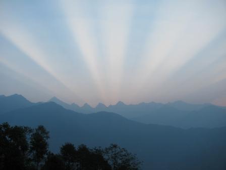
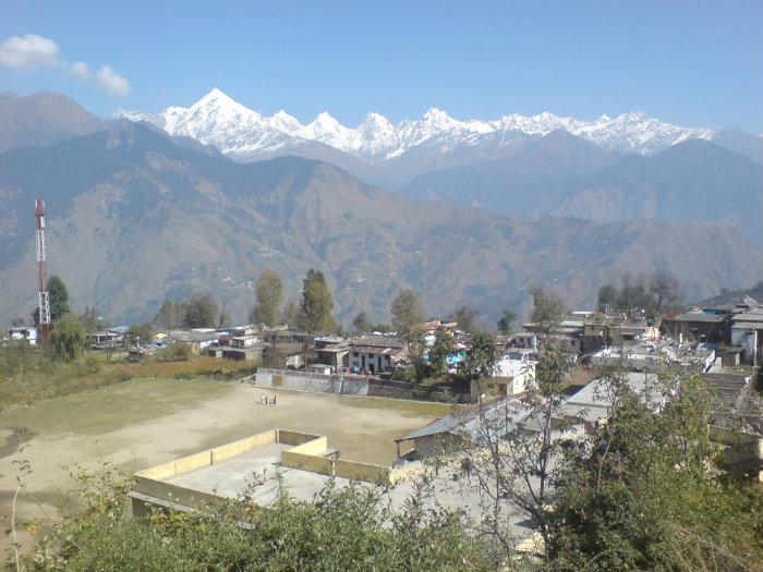
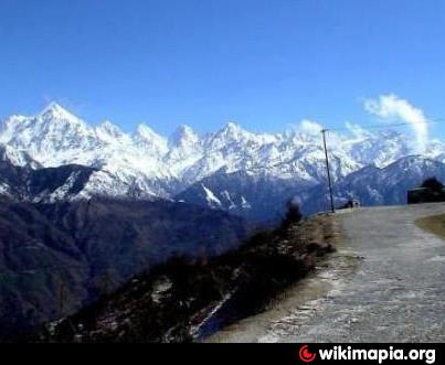
Its name refers to a 'place with snow'. Situated on the banks of Goriganga river, it is a fast-growing tourist destination.
One of the best places to visit in Kumaon area of Uttarakhand. Munsyari is famous for Panchachuli view, rajma pulses and Milam trek.
Elevation 2,200 m
Its name refers to a 'place with snow'. Situated on the banks of Goriganga river, it is a fast-growing tourist destination.
One of the best places to visit in Kumaon area of Uttarakhand. Munsyari is famous for Panchachuli view, rajma pulses and Milam trek.
Wikipedia article: http://en.wikipedia.org/wiki/Munsiyari
Nearby cities:
Coordinates: 30°4'11"N 80°14'28"E
- Ranikhet 93 km
- Shimla 322 km
- Dharamshala 447 km
- Kargil 636 km
- Abbottabad 812 km
- Kalimpong Town (कालेबुङ) 867 km
- Kajīr Marko Hill Station 1253 km
- Kohima 1440 km
- Yercaud 2029 km
- Kodaikanal 2224 km
- chulkot 5.8 km
- Choribagarh Football Ground Bangapani 14 km
- CHORIBAGARH 15 km
- jara jibuli.... 16 km
- Khatera 20 km
- Chama 21 km
- ADECHAURA ( District Pithoragarh) 24 km
- seema(added by basant chuphal) 24 km
- Nagling (6041 m) 24 km
- Baligad Cintelia 24 km