Ogunquit
| town (New England / New York)
USA /
Maine /
Ogunquit /
World
/ USA
/ Maine
/ Ogunquit
World / United States / New Hampshire
town (New England / New York), draw only border
Ogunquit, which meant "coastal lagoon" to native Abenaki Indians, was first a village within Wells, which was settled in 1641. The first sawmill here was established in 1686, and shipbuilding developed along the tidal Ogunquit River. Besides constructing schooners and brigs, local shipwrights built the famous "Ogunquit dory."
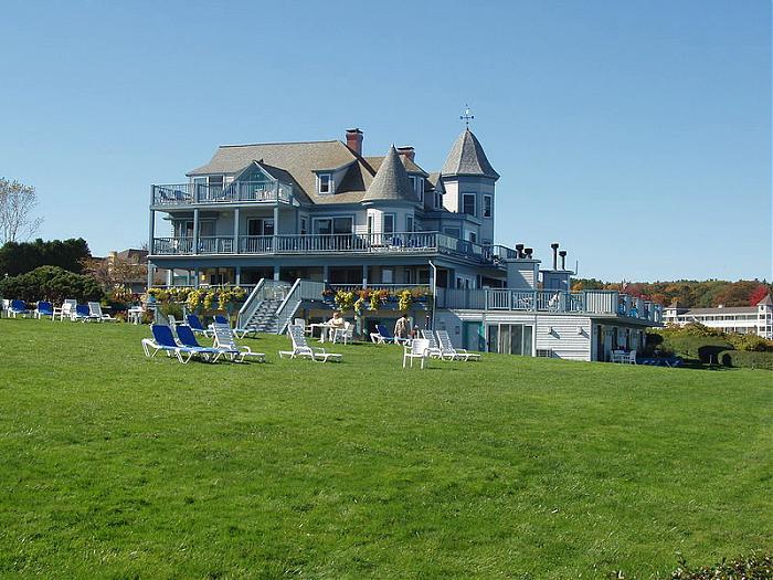
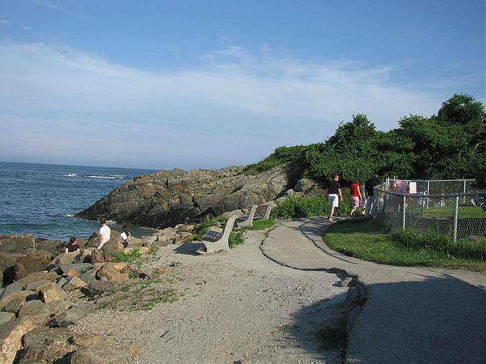
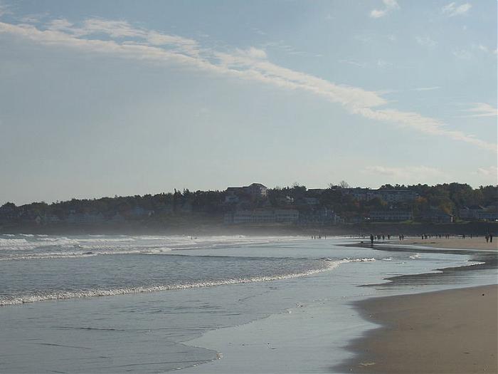
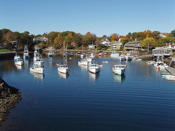
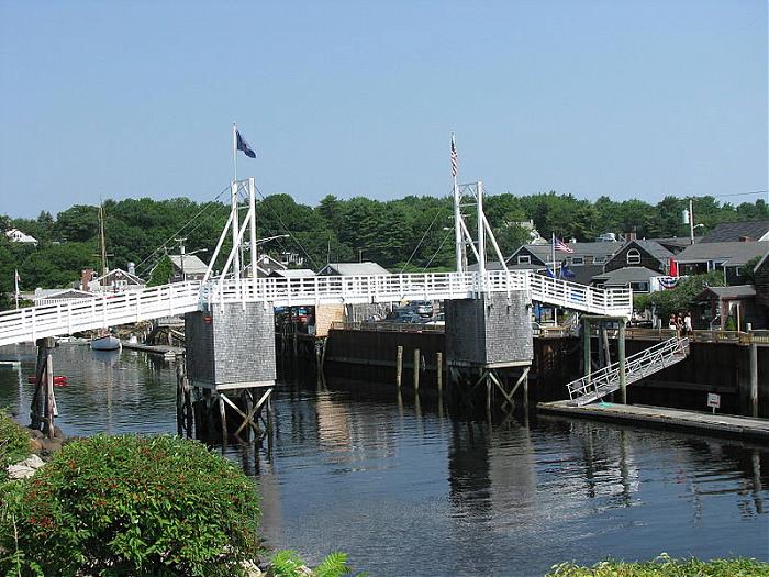
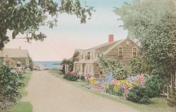
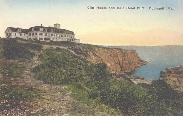
At what was then called Fish Cove, near the unnavigable Josias River, fishing was a major livelihood. But the cove was unprotected by a headland or breakwater from Atlantic storms, so fishermen had to protect their boats by hauling them ashore each night. Resolving to create a safe anchorage, they formed the Fish Cove Harbor Association, and dug a channel across land they purchased to connect Fish Cove with the Josias River. When the trench was complete, in roared the ocean, its erosion helping to further widen the passage. The resulting tidewater basin would be called Perkins Cove, across which spans a manually-operated draw footbridge, possibly one of the most photographed objects in Maine. With a 3 and a half mile beach of pale sand and dunes forming a barrier peninsula, connected to the mainland in 1888 by bridge across the Ogunquit River, the weatherbeaten old village was discovered by artists. It became a popular art colony and tourist area. Particularly after 1898, when the Ogunquit Art Colony was established, it was not unusual to see artists and fishermen plying their respective trades around Perkins Cove. To accommodate summer crowds, several grand seaside hotels and inns were built. Ogunquit is also known for its historical trail known as Marginal Way, which stretches approximately one and one-half miles along the craggy coastline. The walk is scenic, embracing the coast from Perkins Cove to Ogunquit Beach. Today, Ogunquit remains a vibrant seasonal resort town, having separated from Wells in 1980. Visitors often arrive from great distances and in great numbers, some from Canada.
At what was then called Fish Cove, near the unnavigable Josias River, fishing was a major livelihood. But the cove was unprotected by a headland or breakwater from Atlantic storms, so fishermen had to protect their boats by hauling them ashore each night. Resolving to create a safe anchorage, they formed the Fish Cove Harbor Association, and dug a channel across land they purchased to connect Fish Cove with the Josias River. When the trench was complete, in roared the ocean, its erosion helping to further widen the passage. The resulting tidewater basin would be called Perkins Cove, across which spans a manually-operated draw footbridge, possibly one of the most photographed objects in Maine. With a 3 and a half mile beach of pale sand and dunes forming a barrier peninsula, connected to the mainland in 1888 by bridge across the Ogunquit River, the weatherbeaten old village was discovered by artists. It became a popular art colony and tourist area. Particularly after 1898, when the Ogunquit Art Colony was established, it was not unusual to see artists and fishermen plying their respective trades around Perkins Cove. To accommodate summer crowds, several grand seaside hotels and inns were built. Ogunquit is also known for its historical trail known as Marginal Way, which stretches approximately one and one-half miles along the craggy coastline. The walk is scenic, embracing the coast from Perkins Cove to Ogunquit Beach. Today, Ogunquit remains a vibrant seasonal resort town, having separated from Wells in 1980. Visitors often arrive from great distances and in great numbers, some from Canada.
Wikipedia article: http://en.wikipedia.org/wiki/Ogunquit,_Maine
Nearby cities:
Coordinates: 43°14'58"N 70°37'12"W
- Biddeford, Maine 33 km
- Sanford, Maine 34 km
- Saco, Maine 39 km
- Greater Portland 57 km
- Standish, Maine 71 km
- Ossipee 84 km
- Moultonborough, New Hampshire 95 km
- Meredith, New Hampshire 97 km
- Bridgton 101 km
- Livermore, New Hampshire 131 km
- Ogunquit Beach 3.3 km
- Cape Neddick Country Club 3.7 km
- Old Marsh Country Club 6.3 km
- Sea-Vu West Resort RV Park 7.1 km
- Cape Neddick 8.9 km
- Wells Harbor 9 km
- Drake's Island 10 km
- York Beach - Long Sands 10 km
- Exit 7 11 km
- York Golf & Tennis Club 13 km