Deuzeld (Antwerp)
Belgium /
Antwerpen /
Brasschaat /
Antwerp
World
/ Belgium
/ Antwerpen
/ Brasschaat
World / Belgium / Vlaanderen / Antwerpen / Antwerpen
neighbourhood, draw only border
Deuzeld, first mentioned in 1232.
In 1685 there were early roads, but no settlement of any significance.
As of 1834 there were 21 houses and 125 inhabitants.
In 1857 houses were build at such rate that in 1892 the population grew to 800.
In 1895 the school was inaugurated and two years later the church was completed, the parish Deuzeld was acknowledged.
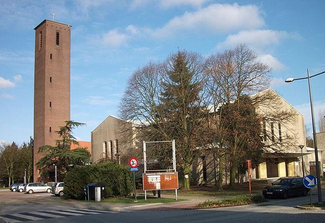
1933 population grew over 4.000 and a new church was needed.
Only in 1960 the start of the new church was given.
1967 the old church is closed for good.
In 1685 there were early roads, but no settlement of any significance.
As of 1834 there were 21 houses and 125 inhabitants.
In 1857 houses were build at such rate that in 1892 the population grew to 800.
In 1895 the school was inaugurated and two years later the church was completed, the parish Deuzeld was acknowledged.
1933 population grew over 4.000 and a new church was needed.
Only in 1960 the start of the new church was given.
1967 the old church is closed for good.
Wikipedia article: https://en.wikipedia.org/wiki/Deuzeld
Nearby cities:
Coordinates: 51°14'45"N 4°27'47"E
- Wuustwezel (municipality) 21 km
- Antwerp (municipality) 22 km
- Beveren (Municipality) 25 km
- Hoogstraten (municipality) 32 km
- Baarle-Nassau 34 km
- Zundert (municipality) 34 km
- Roosendaal (municipality) 38 km
- Bergen op Zoom (municipality) 40 km
- Alphen-Chaam 40 km
- Breda 46 km
- Fortress Merksem 2 km
- Straatsburgdok 3.5 km
- Zuidnatie NV - Terminal South 3.7 km
- Vriesdonk 3.7 km
- Kattendijkdok 4.1 km
- Municipal dry docks 4.2 km
- Albertdok 4.5 km
- Amerikadok 4.6 km
- Ekeren Interchange 4.6 km
- Classification yard Antwerpen-Noord 8.2 km