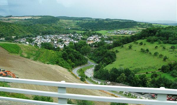
Langsur
Luxembourg /
Grevenmacher /
Wasserbillig /
World
/ Luxembourg
/ Grevenmacher
/ Wasserbillig
World / Germany / Rheinland-Pfalz / Trier
village, municipality
Wikipedia article: http://en.wikipedia.org/wiki/Langsur
Nearby cities:
Coordinates: 49°43'25"N 6°30'2"E
- Manderen 29 km
- Hesperange 31 km
- Basse-Rentgen 34 km
- Zoufftgen 39 km
- Yutz 45 km
- Aubange (Municipality) 59 km
- Arlon (municipality) 59 km
- Carling 62 km
- Forbach 63 km
- Musson (Municipality) 65 km
- Fausermühle 3.5 km
- Mertert port 3.7 km
- Schorenshof 7.7 km
- Potaschberg 8.9 km
- Guardian Grevenmacher 9 km
- Biwerbach 10 km
- Solar park 11 km
- S.i.g.r.e Mülldeponie 11 km
- Ses Global/ses Astra 13 km
- Grand Duchy of Luxembourg 29 km