Lixus
Morocco /
Tangier-Tetouan /
Larache /
World
/ Morocco
/ Tangier-Tetouan
/ Larache
, 6 km from center (العراءش, العراىش)
World / Morocco / Tanger - Tétouan / Larache / Larache
ruins, archaeological site, Roman Empire
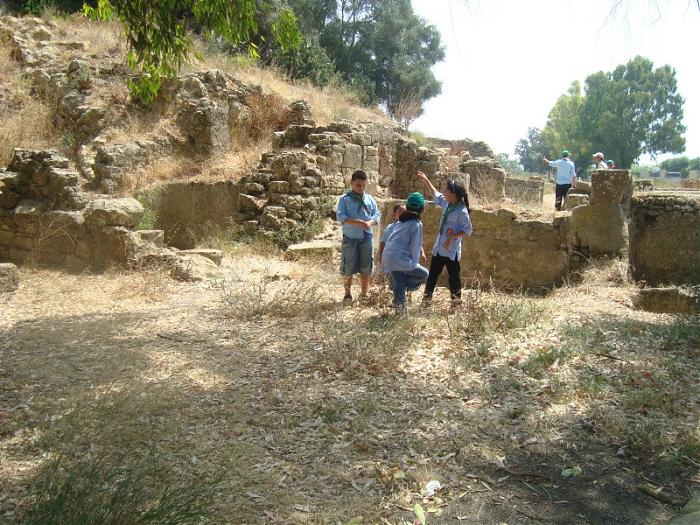
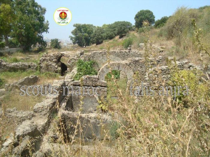
Lixus ancient city site is located on the right bank of the river Loukkos, about 4 km from its mouth. Lixus is built on a hill known among locals as the place name Tchemich.
The earliest mention dates back to the journey of Pseudo Scylax (fourth century BC.), Makes "Lixos" a Phoenician city. Indications of a little more detail is provided by other ancient texts, especially that of Pliny, which places one of the exploits of Hercules (the collection of golden apples of the Hesperides gardens) and to Lixus Lixus like this older Phoenician colony of the West Mediterranean (XII century BC.), indicating that the temple of Lixus is older than Gades.
Archaeological research undertaken at the site since the twenties and continues to this day as part of partnership programs have provided important data on the different phases of the long history of the site.
add by scouts marc _ fahs anjra
for mor information and photos scoutsfahsanjra.maktoobblog.com
Nearby cities:
Coordinates: 35°12'0"N 6°6'31"W
- cyte historique zilil موقع زيليل الأثري 40 km
- Cotta ruins 64 km
- Site archéologique Banasa 66 km
- site archéologique Rirha -by h-raf- 100 km
- Archaeological site of Baelo Claudia 104 km
- Salé anthropological and archaeological site 145 km
- Chellah 148 km
- Kebibat quarry 150 km
- Thomas I Quarry 233 km
- Oulad Hamida Quarry 233 km
- INstitut Technique AGricole LArache 2.3 km
- Project Lixus Palms 4 km
- abdelaoui marzouk maison 4.2 km
- hay lekouach 4.3 km
- khmiss sahel 6.5 km
- ورثة المرحوم اولاد مرزوق 6.5 km
- ouad mechirae 6.8 km
- madchar balat ahsan dchar f l3alam 8.4 km
- rehyene 10 km
- oulad kla3i bkl 12 km