Sri Ganganagar
India /
Rajasthan /
Ganganagar /
World
/ India
/ Rajasthan
/ Ganganagar
World / India / Rajasthan / Ganganagar
city, taluka headquarter, district headquarter
Tehsil Sriganganagar, District Sriganganagar, Rajasthan
Shri GanganagarNamed after Maharaja Ganga Singh of Bikaner, Shri Ganganagar District was part of Bikaner State. This was mostly uninhabited region. History of this district is testimony of vision and efforts of Maharaja Ganga Singh who visualised and build Gang Canal after the Indian famine of 1899–1900. Waters of Satluj river were brought into the region through 89-mile long Gang Canal in 1927 and turned this region into a breadbasket[1] of Rajasthan.
Sri Ganganagar is a northern most city of Rajasthan State of western India . Sri Ganganagar is situated at the point where the Satluj Waters enters Rajasthan.The foundation stone of the Gang Canal Head Works at Ferozepur was laid on 5 December 1925 and the work completed in 1927 by constructing 89 miles of lined canal. The opening ceremony was performed on 26 October 1927. Sri Ganganagar is one of the well planned cities of India . It is said to be influenced by the town planning of Paris . It is divided into residential blocks and commercial area which includes Dhan Mandi. Residential Blocks have large parks for each Blocks and Community centers and places of worship are at junctions of three or four blocks. Bagri and Punjabi languages are spoken by majority of population. Econonmy of Sri Ganganagar District is dependent on agriculture.The city has Cotton Ginning and Pressing factories, Mustard Oil mills and Sugar Mills Ltd.It also has spinning and textile Factories. Because of its prosperity from agriculture, Sri Ganganagar District also has a large number of automobiles and it becomes one of the largest automobile markets in India. The climate of Sri Ganganagar varies to extreme limits. The Summer Temperature reaches up to 50° Celsius and Winter Temperature dips just around 0° Celsius. The average annual rainfall is only 20cms. Ganganagar district known as "the food basket of Rajasthan".Although district Ganganagar lies in great Thar desert but irrigation by Gang canal and Ignp canal has changed flora and fauna.We can classify district into 5 geographical regions.
Region irrigated by Gang canal and Bhakhra canal tributories:northern region,which is 3/4 of District resembles like fertile plains of Punjab,but still some areas like area between Raisinghnagar-Vijaynagar towns has desert like conditions.
Though irrigation has made Ganganagar greener but still sandy dunes can be seen.A photo taken in Gharsana tehsil.
Area irrigated by Suratgarh branch of IGNP canal:-
Anupgarh branch of IGNP canal is the main source of irrigation in southern tehsils, photo taken in Gharsana Tehsil.
* Area irrigated by Anoopgarh branch of IGNP canal:It comprises Anoopgarh & Gharsana tehsils.It is the southern most region of district,of which more area has been converted into plains but still sandy dunes can be seen.
Naali belt:This is a narrow basin of Ghaggar river.It is the single river of district.It is a seasonal river which flows in rainy season.It enters in the district near Suratgarh and then runs in areas of Jaitsar,Vijaynagar,Anoopgarh and then crosses Indo-Pak border.
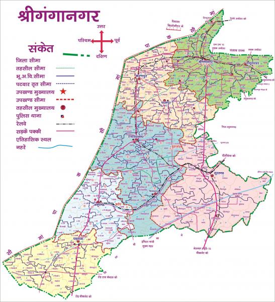
'Uncha Tibba'(high sandy dunes) area of Suratgarh tehsil: Large sandy dunes and lack of water are conditions here.This area can be said 'real desert'.People of this area face harsh conditions of desert.There are following 9 tehsils in Ganganagar district.
1 Sri Ganganagar
2 Sri Karanpur
3 Sadulshahar
4 Padampur
5 Raisinghnagar
6 Suratgarh
7 Anoopgarh
8 Shri Vijaynagar
9 Gharsana
(B)Other major towns, villages:- Kesarisinghpur, Gajsinghpur, Ramsinghpur, Jaitsar, Rawla Mandi are other major towns whereas Lalgarh Jatan, Rirmalsar, Rajiasar, 365 hd, Patroda, Sameja kothi,Chunawadh, Hindumalkot Bajuwala,Birmana are other small towns and villages. Many towns and Cities in Sri Ganganagar District are named after members of The royal family of erstwhile Bikaner State.
Shri GanganagarNamed after Maharaja Ganga Singh of Bikaner, Shri Ganganagar District was part of Bikaner State. This was mostly uninhabited region. History of this district is testimony of vision and efforts of Maharaja Ganga Singh who visualised and build Gang Canal after the Indian famine of 1899–1900. Waters of Satluj river were brought into the region through 89-mile long Gang Canal in 1927 and turned this region into a breadbasket[1] of Rajasthan.
Sri Ganganagar is a northern most city of Rajasthan State of western India . Sri Ganganagar is situated at the point where the Satluj Waters enters Rajasthan.The foundation stone of the Gang Canal Head Works at Ferozepur was laid on 5 December 1925 and the work completed in 1927 by constructing 89 miles of lined canal. The opening ceremony was performed on 26 October 1927. Sri Ganganagar is one of the well planned cities of India . It is said to be influenced by the town planning of Paris . It is divided into residential blocks and commercial area which includes Dhan Mandi. Residential Blocks have large parks for each Blocks and Community centers and places of worship are at junctions of three or four blocks. Bagri and Punjabi languages are spoken by majority of population. Econonmy of Sri Ganganagar District is dependent on agriculture.The city has Cotton Ginning and Pressing factories, Mustard Oil mills and Sugar Mills Ltd.It also has spinning and textile Factories. Because of its prosperity from agriculture, Sri Ganganagar District also has a large number of automobiles and it becomes one of the largest automobile markets in India. The climate of Sri Ganganagar varies to extreme limits. The Summer Temperature reaches up to 50° Celsius and Winter Temperature dips just around 0° Celsius. The average annual rainfall is only 20cms. Ganganagar district known as "the food basket of Rajasthan".Although district Ganganagar lies in great Thar desert but irrigation by Gang canal and Ignp canal has changed flora and fauna.We can classify district into 5 geographical regions.
Region irrigated by Gang canal and Bhakhra canal tributories:northern region,which is 3/4 of District resembles like fertile plains of Punjab,but still some areas like area between Raisinghnagar-Vijaynagar towns has desert like conditions.
Though irrigation has made Ganganagar greener but still sandy dunes can be seen.A photo taken in Gharsana tehsil.
Area irrigated by Suratgarh branch of IGNP canal:-
Anupgarh branch of IGNP canal is the main source of irrigation in southern tehsils, photo taken in Gharsana Tehsil.
* Area irrigated by Anoopgarh branch of IGNP canal:It comprises Anoopgarh & Gharsana tehsils.It is the southern most region of district,of which more area has been converted into plains but still sandy dunes can be seen.
Naali belt:This is a narrow basin of Ghaggar river.It is the single river of district.It is a seasonal river which flows in rainy season.It enters in the district near Suratgarh and then runs in areas of Jaitsar,Vijaynagar,Anoopgarh and then crosses Indo-Pak border.
'Uncha Tibba'(high sandy dunes) area of Suratgarh tehsil: Large sandy dunes and lack of water are conditions here.This area can be said 'real desert'.People of this area face harsh conditions of desert.There are following 9 tehsils in Ganganagar district.
1 Sri Ganganagar
2 Sri Karanpur
3 Sadulshahar
4 Padampur
5 Raisinghnagar
6 Suratgarh
7 Anoopgarh
8 Shri Vijaynagar
9 Gharsana
(B)Other major towns, villages:- Kesarisinghpur, Gajsinghpur, Ramsinghpur, Jaitsar, Rawla Mandi are other major towns whereas Lalgarh Jatan, Rirmalsar, Rajiasar, 365 hd, Patroda, Sameja kothi,Chunawadh, Hindumalkot Bajuwala,Birmana are other small towns and villages. Many towns and Cities in Sri Ganganagar District are named after members of The royal family of erstwhile Bikaner State.
Wikipedia article: http://en.wikipedia.org/wiki/ganganagar
Nearby cities:
Coordinates: 29°54'50"N 73°52'30"E
- Bahawalnagar 66 km
- Pakpattan 72 km
- Bathinda 105 km
- Sirsa 114 km
- Firozpur 136 km
- Lahore 195 km
- Shaikhupura 204 km
- Ludhiana 215 km
- Amritsar 219 km
- Jalandhar 225 km
- New Dhan Mandi 0.4 km
- Naya Chak 0.7 km
- Anand Vihar 1.6 km
- Shyam Nagar 2.4 km
- Kunj Vihar 2.6 km
- Sadhbhavna Nagar 3 km
- Ridhi Sidhi Enclave 3.1 km
- Ridhi Sidhi II 3.8 km
- home land city 4.2 km
- Chak 5A Sri Ganganagar 5.6 km