Awanui
New Zealand /
Northland /
Awanui /
World
/ New Zealand
/ Northland
/ Awanui
World / New Zealand / Northland / Far North
village
Add category

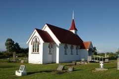
Awanui is a river port located 7 km north of Kaitaia, New Zealand. It lies at the south of the Aupouri Peninsula of the Northland Region. The Awanui River flows north to Rangaunu Bay. In the 1920s, kauri timber and gum from Kaitaia moved to the coast through Awanui.
State Highway 1 and 10 intersect at Awanui. Waiharara is 16 km to the north west, Kaingaroa is about 6 km to the north east, and Kaitaia is 7 km to the south.
The population was 351 in the 2006 Census, a decrease of 18 from 2001.
State Highway 1 and 10 intersect at Awanui. Waiharara is 16 km to the north west, Kaingaroa is about 6 km to the north east, and Kaitaia is 7 km to the south.
The population was 351 in the 2006 Census, a decrease of 18 from 2001.
Wikipedia article: http://en.wikipedia.org/wiki/Awanui
Nearby cities:
Coordinates: 35°2'39"S 173°15'22"E
- Kaeo 44 km
- Hikurangi 110 km
- Kaiwaka 162 km
- Kumeu / Huapai 223 km
- Ngongotaha 426 km
- Bay View 581 km
- Halcombe 599 km
- Havelock North 605 km
- Paraparaumu 666 km
- Opaki 684 km
- Rangaunu Harbour 11 km
- Ahipara Bay 18 km
- Tauroa Peninsula 22 km
- Karikari Peninsula 22 km
- Doubtless Bay 23 km
- Taipa Bay-Mangonui 23 km
- Mangonui Harbour 27 km
- Ninety Mile Beach 36 km
- Aupouri Peninsula 47 km
- Hokianga Harbour 48 km