Paraibuna (Brazil)
Brazil /
Sao Paulo /
Santa Branca /
World
/ Brazil
/ Sao Paulo
/ Santa Branca
World / Brazil / São Paulo / Paraibuna
city, municipality
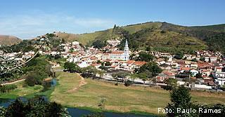

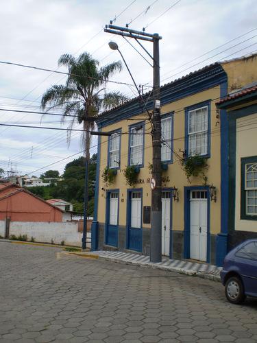
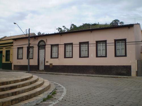
Paraibuna is a municipality in the state of São Paulo in Brazil. The population in 2004 is 18,096 and the area is 811.76 km². The elevation is 635 m. This place name comes from the Tupi language.
Paraibuna is linked with the Rodovia Governador Carvalho Pinto.
History
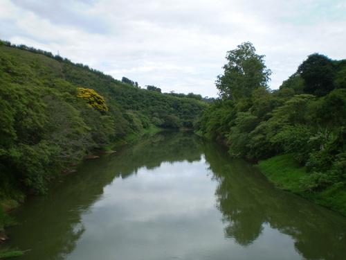
PARAIBUNA -- from the Tupi Guarani for river (or, perhaps, fish) of black waters - was founded on June 13, 1666 with the construction of a hut and a chapel in honor of St. Anthony.
On June 3, 1773 Manuel Antonio assumed the administration of the settlement Santo Antonio da Barra de Paraibuna. In 1812 the parish was established by the Prince Regent, and made a village, which was raised to a town in 1857.
From 1830 to 1870 the area was known for its coffee plantations, and many farms, including the Fazenda São Pedro, were created for that purpose.
With the decline of coffee plantations, farmers started to grow cotton. During this time Paraibuna began its financial decline.
A fresh impetus came to the county with the initiation of dairy-cattle breeding since 1922. Other economic progress derived from the construction of the President Dutra Freeway (Rio de Janeiro to São Paulo) and the Tamoios Highway.
Construction of the Paraibuna-Paraitinga Dam in the 1960s brought new difficulties to the community: the inundation of prime land and the exodus of agricultural workers. Today the county invests in tourism in order to improve its economy.
External links
fauser.com.br/index-us.htm
(Portuguese) www.paraibuna.sp.gov.br
(Portuguese) citybrazil.com.br
(Portuguese) Paraibuna on Explorevale
Northwest: Jacareí North: Jambeiro Northeast: Redenção da Serra
West: Santa Branca Paraibuna East: Natividade da Serra
Southwest: Salesópolis South: Caraguatatuba
Statistics
State: São Paulo
Founded: 1666
Area: 811.76 km²
Population: 18,960 (2004)
Ranked 259th
Population density: 23.36/km²
Elevation: 635 m
Postal code: 12260-xxx
Area/distance code: (00))55-12
Website: www.paraibuna.sp.gov.br
Paraibuna is linked with the Rodovia Governador Carvalho Pinto.
History
PARAIBUNA -- from the Tupi Guarani for river (or, perhaps, fish) of black waters - was founded on June 13, 1666 with the construction of a hut and a chapel in honor of St. Anthony.
On June 3, 1773 Manuel Antonio assumed the administration of the settlement Santo Antonio da Barra de Paraibuna. In 1812 the parish was established by the Prince Regent, and made a village, which was raised to a town in 1857.
From 1830 to 1870 the area was known for its coffee plantations, and many farms, including the Fazenda São Pedro, were created for that purpose.
With the decline of coffee plantations, farmers started to grow cotton. During this time Paraibuna began its financial decline.
A fresh impetus came to the county with the initiation of dairy-cattle breeding since 1922. Other economic progress derived from the construction of the President Dutra Freeway (Rio de Janeiro to São Paulo) and the Tamoios Highway.
Construction of the Paraibuna-Paraitinga Dam in the 1960s brought new difficulties to the community: the inundation of prime land and the exodus of agricultural workers. Today the county invests in tourism in order to improve its economy.
External links
fauser.com.br/index-us.htm
(Portuguese) www.paraibuna.sp.gov.br
(Portuguese) citybrazil.com.br
(Portuguese) Paraibuna on Explorevale
Northwest: Jacareí North: Jambeiro Northeast: Redenção da Serra
West: Santa Branca Paraibuna East: Natividade da Serra
Southwest: Salesópolis South: Caraguatatuba
Statistics
State: São Paulo
Founded: 1666
Area: 811.76 km²
Population: 18,960 (2004)
Ranked 259th
Population density: 23.36/km²
Elevation: 635 m
Postal code: 12260-xxx
Area/distance code: (00))55-12
Website: www.paraibuna.sp.gov.br
Wikipedia article: http://en.wikipedia.org/wiki/Paraibuna
Nearby cities:
Coordinates: 23°28'24"S 45°37'17"W
- São Paulo 123 km
- Itapetininga 285 km
- Eldorado 300 km
- Cananeia 302 km
- Capão Bonito 305 km
- Botucatu 345 km
- Itapeva 365 km
- Campo Largo 462 km
- Ponta Grossa 491 km
- Palmeira 520 km
- Condominio Quinta dos Lagos 3.3 km
- Cemitério Municipal de Paraibuna 10 km
- Ferry boat terminal 19 km
- Prefeitura Municipal 21 km
- Caraguatatuba Adminstrative Center - Serra do Mar State Park 21 km
- Marine 21 km
- Cemetery 23 km
- Cônego Higino Corrêa Square 25 km
- Jambeiro Cemetery 25 km
- Almeida Gil Square 25 km