Mount Jefferson
USA /
Oregon /
Idanha /
World
/ USA
/ Oregon
/ Idanha
World / United States / Oregon
mountain, volcano
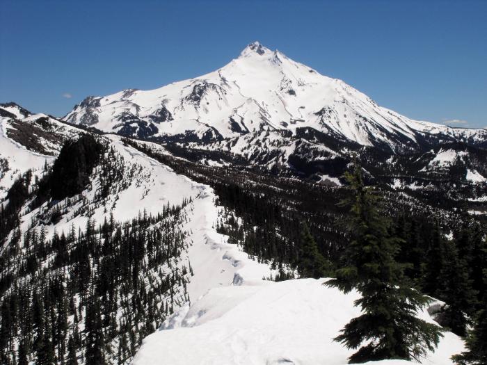
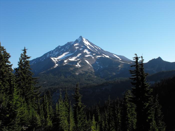

Mount Jefferson is Oregon's second-tallest mountain at 10,497 feet/3199m. This craggy volcano (possibly extinct, but scientists aren't 100% sure about that) is topped by a 400-foot sheer pinnacle of crumbling rock that gives Jefferson its well-deserved reputation as the most difficult of Oregon's Cascade summits to climb. The centerpiece of a large wilderness area in the north-central part of the state, the eastern flank of the mountain is part of the Warm Springs Indian Reservation.
Jefferson was named in the spring of 1806 by Lewis and Clark who sighted it from near present-day Portland and named it for President Thomas Jefferson, who sponsored their journey to the Pacific. This was the first major Cascade peak to be named for an American president and not for a British admiral or dignitary, as in the case of Mt. Baker, Rainier, Hood and St. Helens.
peakbagger.com/peak.aspx?pid=2401
www.topoquest.com/map.php?lat=44.67429&lon=-121.79896&d...
Wikipedia article: http://en.wikipedia.org/wiki/Mount_Jefferson_(Oregon)
Nearby cities:
Coordinates: 44°40'33"N 121°48'2"W
- Three Sisters 54 km
- South Sister 62 km
- Newberry National Volcanic Monument 82 km
- Lookout Mountain 94 km
- Horse Ridge 98 km
- Paulina Mountain 107 km
- Newberry Caldera 111 km
- Davis Mountain 112 km
- Maiden Peak 114 km
- Hamner Butte 120 km
- Bald Peter 8.8 km
- Olallie Scenic Area 14 km
- Breitenbush Mountain 15 km
- Sisi Butte 25 km
- West Pinhead Butte 29 km
- South Pinhead Butte 29 km
- Detroit Lake 31 km
- Warm Springs Indian Reservation 36 km
- Wests Butte 44 km
- Mount Hood National Forest 58 km
Comments