Malham Cove
United Kingdom /
England /
Gargrave /
Cove Road
World
/ United Kingdom
/ England
/ Gargrave
World / United Kingdom / England
cliff
Add category
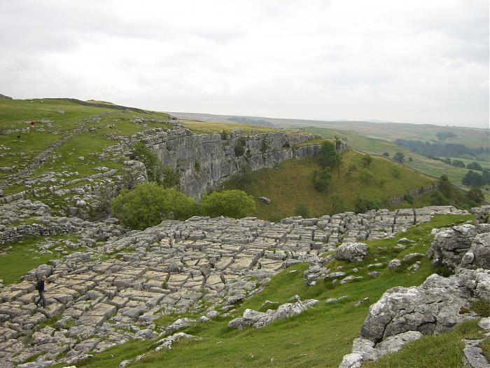
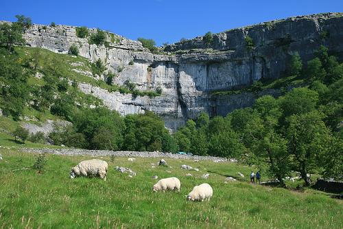
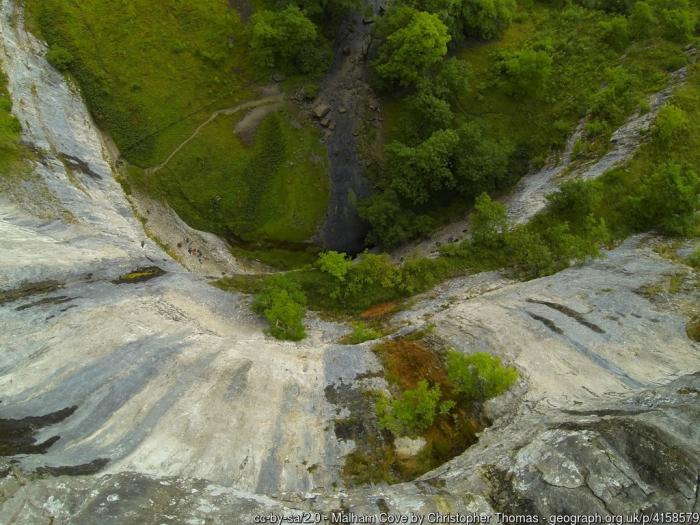
A large curved limestone formation formed by a waterfall carrying meltwater from glaciers at the end of the last Ice Age more than 12,000 years ago. Today it is a well-known beauty spot within the Yorkshire Dales National Park. A large limestone pavement is above the cove. -Adapted from Wikipedia.
Photos:
1&2) Provenance unknown
3) www.geograph.org.uk/photo/4158579
Photos:
1&2) Provenance unknown
3) www.geograph.org.uk/photo/4158579
Wikipedia article: http://en.wikipedia.org/wiki/Malham_Cove
Nearby cities:
Coordinates: 54°4'17"N 2°9'27"W
- Cliffs of Moher / Aillte an Mhothair 499 km
- Las Almenas 3480 km
- Pijitawabik Palisades 5583 km
- Merrill Springs Rim 7617 km
- Buckhorn Draw, San Rafael Swell, Utah 7626 km
- Vermilion Cliffs 7898 km
- Walnut Canyon National Monument 8024 km
- Aubrey Cliffs 8069 km
- Cowboy Rim 8193 km
- Hōlei Pali 11471 km
- Malham Tarn 2.7 km
- Settle Golf Club 9 km
- Arcow Quarries 11 km
- Dry Rigg Quarry 11 km
- Pen-y-ghent 11 km
- Hanson Aggregates Ltd Horton Quarry 13 km
- Ingleborough 723 m 18 km
- Champion Common 18 km
- Stocks Reservoir 19 km
- Yorkshire Dales National Park 21 km