Åland Islands
Finland /
Ahvenanmaa /
Lumparland /
World
/ Finland
/ Ahvenanmaa
/ Lumparland
World / Åland Islands
municipality, demilitarized zone, archipelago, invisible

The Åland Islands, or Landskapet Åland in Swedish, is an autonomous, demilitarized and unilingually Swedish province of Finland, consisting of more than 6,500 islands and skerries. The Åland Islands are an archipelago at the entrance to the Gulf of Bothnia, about 40 km from the coast of Sweden, and 25 km from that of Finland.
The Finnish language name for the province is Ahvenanmaa. In English the Latin name Alandia might sometimes be seen.
The status of the Swedish language, the extensive autonomy and the competence of Åland's legislative assembly are provided for in a
specific Act on the Autonomy of Åland (last revision from 1991) given by Finland's legislative assembly, the Eduskunta, based on international treaties giving Åland also a neutral and demilitarised status, which
means that no military headquarters or forces may be placed on the islands. The special status of the Åland Islands is based on a decision given by the League of Nations in 1921, and in a somewhat different context reafirmed in the treaty on Finland's admission to the European Union.
The Åland Islands belonged to the provinces Sweden had to cede to Russia by the treaty of Fredrikshamn in September 1809, and came then to be a part of the semi-autonomous Grand duchy of Finland.
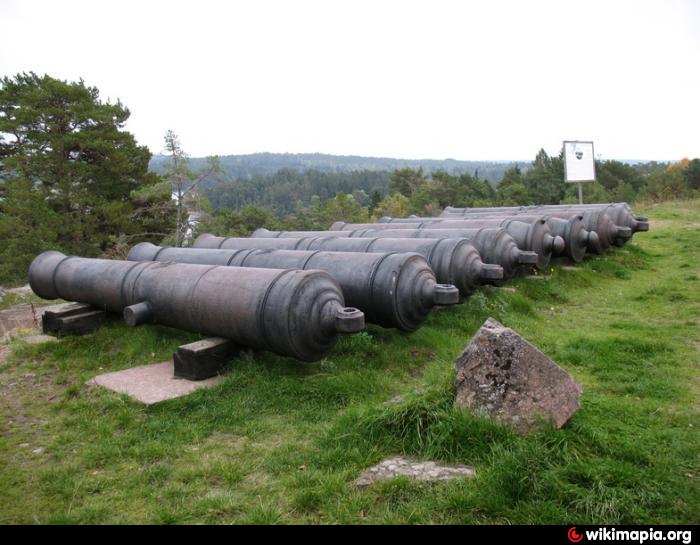
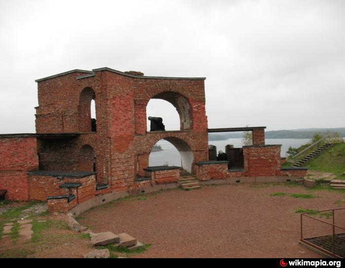
When the islands were ceded to Russia, the Swedes were unable to secure a provision that the islands should not be fortified. The question was, however, a vital one not only for Sweden but for Great Britain, whose trade in the Baltic was threatened, why the islands were demilitarized following the Crimean War.
During the Civil War in Finland, 1918, Swedish troops intervened as a peacekeeping force between the Russian troops, until then stationed on the islands, and White and Red troops arriving over the ice from Finland. Within weeks the Swedes were replaced by German troops occupying on request of independent Finland's "White" government.
From 1917 the residents of the islands aimed at having the islands ceded back to their mother country, Sweden. A petition for secession from Finland was signed by 96.2% of Åland's native adults (those working or living abroad excluded, although serious questions are later raised regarding this extraordinary high figure). These sentiments had grown strong particularly in the face of anti-Swedish tendencies in Finland, Finnish nationalism fueled by Finland's struggle to retain its autonomy, and the Finnish resistance against Russification. Also the conflict between the privileged Swedish speaking minority in Finland and the Finnish speaking majority, which since the 1840s had been prominent in Finland's political life, contributed to the Åland population's fear for its future in Finland.
However, as Finland was not willing to cede the islands, they were offered an autonomous status instead of reannexation. The residents did nevertheless not approve the offer, and the dispute over the islands was submitted to the League of Nations. The latter decided that Finland should retain the sovereignty over the province, but the Åland Islands should be made an autonomous territory. Thus Finland is under an obligation to ensure the residents of the Åland Islands a right to maintain the Swedish language, as well as their own culture and local traditions. At the same time, an international treaty was concluded on the neutral status of Åland, under which it is prohibited to place military headquarters or forces on the islands.
In the course of the 20th century, the Finnish sovereignty has been perceived as benevolent, and even beneficial, by increasing majorities of the islanders. Together with disappointment over insufficient support from Sweden in the League of Nations, over Swedish disrespect for Åland's demilitarized status in the 1930s, and to some degree a feeling of shared destiny with Finland during and after World War II, this has resulted in a changed perception of Åland's relation to Finland: from "a Swedish province in Finnish possession" to "an autonomous part of Finland".
In connection with Finland's admission to the European Union a protocol on the Åland Islands provides, i. a., that provisions of the European Community Treaty shall not force a change of the existing restrictions for foreigners (i.e. persons who do not enjoy "regional citizenship" (hembygdsrätt) in Åland) to acquire and hold real property, implicating a recognition of a separate nationality.
The Åland Islands occupy a position of great strategic importance, as they command one of the entrances to the port of Stockholm, as well as the approaches to the Gulf of Bothnia, in addition to being situated near the Gulf of Finland.
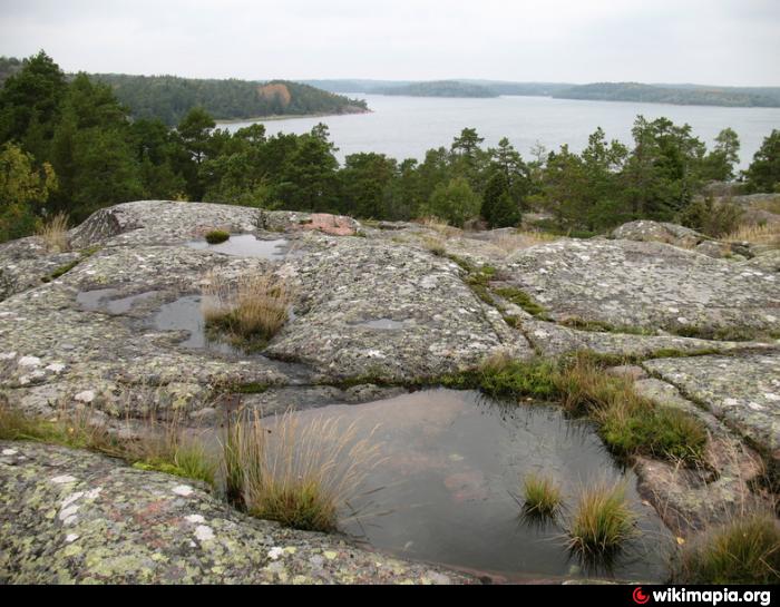
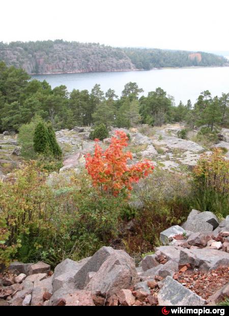
The Åland archipelago consists of nearly three hundred habitable islands, of which about eighty are inhabited; the remainder are merely some 6,000 skerries and desolate rocks. The archipelago is connected to Åboland archipelago in the east (Finnish: Turunmaan saaristo, Swedish: Åbolands skärgård) — the archipelago adjacent to the southwest coast of Finland. Together they form the Archipelago Sea. To West from Åland is Sea of Åland and to North the Bothnian Sea.
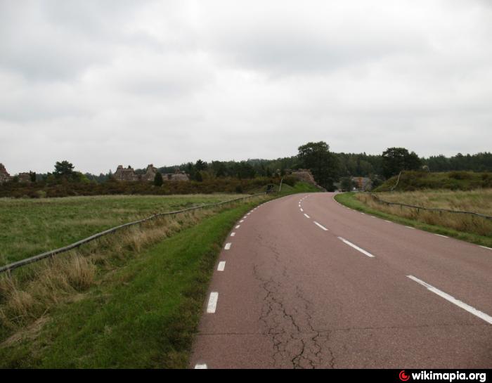
The surface of the islands is generally rocky, the soil thin, and the climate keen. There are several excellent harbours.
The islands' landmass occupies a total area of 1,512 square kilometres (583 sq. mi). Ninety per cent of the population live on Fasta Åland (the Main Island), also the site of the capital town of Mariehamn. Fasta Åland is the largest island in the archipelago, extending over 1,010 square kilometres, more than 70% of the province's land area, and stretching 50 kilometres (31 mi) from north to south and 45 kilometres (28 mi) from east to west.
During the Åland Crisis, the parties sought support from different maps of the islands. On the Swedish map, the most densely populated main island dominated, and many skerries were left out. On the Finnish map, a lot of smaller islands or skerries were, for technical reasons, given a slightly exaggerated size. The Swedish map made the islands appear to be closer to the mainland of Sweden than to Finland; the Finnish map stressed the continuity of the archipelago between the main island and mainland Finland, while a greater gap appeared between the islands and the archipelago on the Swedish side. Although both Finns and Swedes of course argued for their respective interpretations, in retrospect it is hard to say that one is more correct than the other. One consequence is the oft-repeated number of "over 6,000" skerries that was given authority by the outcome of the arbitration.
knowledgerush.com/kr/encyclopedia/History_of_Aland/
The Finnish language name for the province is Ahvenanmaa. In English the Latin name Alandia might sometimes be seen.
The status of the Swedish language, the extensive autonomy and the competence of Åland's legislative assembly are provided for in a
specific Act on the Autonomy of Åland (last revision from 1991) given by Finland's legislative assembly, the Eduskunta, based on international treaties giving Åland also a neutral and demilitarised status, which
means that no military headquarters or forces may be placed on the islands. The special status of the Åland Islands is based on a decision given by the League of Nations in 1921, and in a somewhat different context reafirmed in the treaty on Finland's admission to the European Union.
The Åland Islands belonged to the provinces Sweden had to cede to Russia by the treaty of Fredrikshamn in September 1809, and came then to be a part of the semi-autonomous Grand duchy of Finland.
When the islands were ceded to Russia, the Swedes were unable to secure a provision that the islands should not be fortified. The question was, however, a vital one not only for Sweden but for Great Britain, whose trade in the Baltic was threatened, why the islands were demilitarized following the Crimean War.
During the Civil War in Finland, 1918, Swedish troops intervened as a peacekeeping force between the Russian troops, until then stationed on the islands, and White and Red troops arriving over the ice from Finland. Within weeks the Swedes were replaced by German troops occupying on request of independent Finland's "White" government.
From 1917 the residents of the islands aimed at having the islands ceded back to their mother country, Sweden. A petition for secession from Finland was signed by 96.2% of Åland's native adults (those working or living abroad excluded, although serious questions are later raised regarding this extraordinary high figure). These sentiments had grown strong particularly in the face of anti-Swedish tendencies in Finland, Finnish nationalism fueled by Finland's struggle to retain its autonomy, and the Finnish resistance against Russification. Also the conflict between the privileged Swedish speaking minority in Finland and the Finnish speaking majority, which since the 1840s had been prominent in Finland's political life, contributed to the Åland population's fear for its future in Finland.
However, as Finland was not willing to cede the islands, they were offered an autonomous status instead of reannexation. The residents did nevertheless not approve the offer, and the dispute over the islands was submitted to the League of Nations. The latter decided that Finland should retain the sovereignty over the province, but the Åland Islands should be made an autonomous territory. Thus Finland is under an obligation to ensure the residents of the Åland Islands a right to maintain the Swedish language, as well as their own culture and local traditions. At the same time, an international treaty was concluded on the neutral status of Åland, under which it is prohibited to place military headquarters or forces on the islands.
In the course of the 20th century, the Finnish sovereignty has been perceived as benevolent, and even beneficial, by increasing majorities of the islanders. Together with disappointment over insufficient support from Sweden in the League of Nations, over Swedish disrespect for Åland's demilitarized status in the 1930s, and to some degree a feeling of shared destiny with Finland during and after World War II, this has resulted in a changed perception of Åland's relation to Finland: from "a Swedish province in Finnish possession" to "an autonomous part of Finland".
In connection with Finland's admission to the European Union a protocol on the Åland Islands provides, i. a., that provisions of the European Community Treaty shall not force a change of the existing restrictions for foreigners (i.e. persons who do not enjoy "regional citizenship" (hembygdsrätt) in Åland) to acquire and hold real property, implicating a recognition of a separate nationality.
The Åland Islands occupy a position of great strategic importance, as they command one of the entrances to the port of Stockholm, as well as the approaches to the Gulf of Bothnia, in addition to being situated near the Gulf of Finland.
The Åland archipelago consists of nearly three hundred habitable islands, of which about eighty are inhabited; the remainder are merely some 6,000 skerries and desolate rocks. The archipelago is connected to Åboland archipelago in the east (Finnish: Turunmaan saaristo, Swedish: Åbolands skärgård) — the archipelago adjacent to the southwest coast of Finland. Together they form the Archipelago Sea. To West from Åland is Sea of Åland and to North the Bothnian Sea.
The surface of the islands is generally rocky, the soil thin, and the climate keen. There are several excellent harbours.
The islands' landmass occupies a total area of 1,512 square kilometres (583 sq. mi). Ninety per cent of the population live on Fasta Åland (the Main Island), also the site of the capital town of Mariehamn. Fasta Åland is the largest island in the archipelago, extending over 1,010 square kilometres, more than 70% of the province's land area, and stretching 50 kilometres (31 mi) from north to south and 45 kilometres (28 mi) from east to west.
During the Åland Crisis, the parties sought support from different maps of the islands. On the Swedish map, the most densely populated main island dominated, and many skerries were left out. On the Finnish map, a lot of smaller islands or skerries were, for technical reasons, given a slightly exaggerated size. The Swedish map made the islands appear to be closer to the mainland of Sweden than to Finland; the Finnish map stressed the continuity of the archipelago between the main island and mainland Finland, while a greater gap appeared between the islands and the archipelago on the Swedish side. Although both Finns and Swedes of course argued for their respective interpretations, in retrospect it is hard to say that one is more correct than the other. One consequence is the oft-repeated number of "over 6,000" skerries that was given authority by the outcome of the arbitration.
knowledgerush.com/kr/encyclopedia/History_of_Aland/
Wikipedia article: http://en.wikipedia.org/wiki/Åland_Islands
Nearby cities:
Coordinates: 60°7'16"N 20°15'11"E
- Alsunga municipality 345 km
- Skuodas district municipality 420 km
- Mažeikiai district municipality 423 km
- Kretinga district municipality 445 km
- Plungė district municipality 447 km
- Telšiai district municipality 456 km
- Skiptvet Municipality 518 km
- Oslo 535 km
- Samsø 733 km
- Stavanger Municipality 834 km
- Angö 4.6 km
- Bussö 6.8 km
- Järsö 6.8 km
- Park 7.2 km
- Lumparn Impact Crater 7.6 km
- Töftö 9 km
- Prästö 10 km
- Degerö 13 km
- Vibberholm 14 km
- Lövö, Vårdö 15 km
Comments