Landscape Park Tercino Udoli (Tereziino udoli, Theresientall)
Czech Republic /
Jihocesky /
Nove Hrady /
World
/ Czech Republic
/ Jihocesky
/ Nove Hrady
World / Czech Republic / Jihočeský
park, nature conservation park / area, landscape park


Protected Tercino Park Valley (also Terezino), the National natural monument, is located about 1 km south-west from the Nove Hrady in the valley of the river Stropnice in Novohradske mountains. Originally landscape park is situated on an area of about 140 ha.
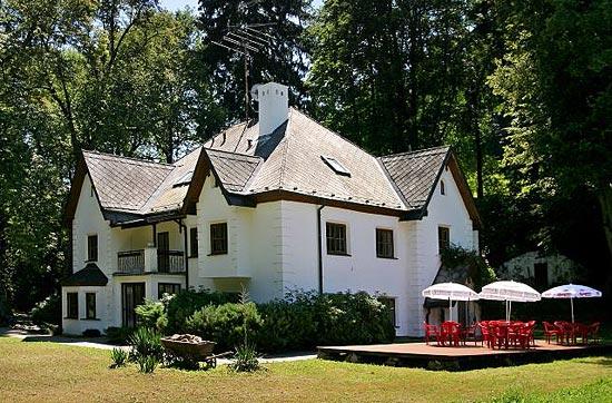
Park was established in the second half of the 18th century by Count Jan Buquoy as a gift to his wife Countess Theresa Buquoy, whose name bears the park today. In the end of the 18th and the beginning of the 19th century underwent the park some romantic modifications. In addition to domestic treesthere were planted some exotic trees and some park buildings were built to spa purposes. The oldest are the Bathhouse from the end of the 18th century and the Blue House from the beginning of the nineteenth century. The main spa building and the Swiss House are dating from the 19th century in Romanticism style. Picturesque scenery of the valley is enhanced in the western part of the park by the artificial waterfall on Stropnice River. In the eastern edge of the park stands on the elevated spot almost original renovated Gothic fortress Cuknstejn.
Park was established in the second half of the 18th century by Count Jan Buquoy as a gift to his wife Countess Theresa Buquoy, whose name bears the park today. In the end of the 18th and the beginning of the 19th century underwent the park some romantic modifications. In addition to domestic treesthere were planted some exotic trees and some park buildings were built to spa purposes. The oldest are the Bathhouse from the end of the 18th century and the Blue House from the beginning of the nineteenth century. The main spa building and the Swiss House are dating from the 19th century in Romanticism style. Picturesque scenery of the valley is enhanced in the western part of the park by the artificial waterfall on Stropnice River. In the eastern edge of the park stands on the elevated spot almost original renovated Gothic fortress Cuknstejn.
Nearby cities:
Coordinates: 48°46'46"N 14°45'19"E
- Puszcza Zielonka Landscape Park 456 km
- Krajna Landscape Park 562 km
- Nadsyansky Regional Landscape Park 583 km
- Chełm Landscape Park 676 km
- Trójmiejski Landscape Park - northern part 690 km
- Hel peninsula 715 km
- Aladaghlar Mahneshan National Geopark (Rainbow mountains) 2919 km
- Ghermezi Landscape (The Rainbow Landscape) 3865 km
- Gara Shiyar Landscape 3968 km
- Kermangan Amazing Mountain Landscape 4525 km
- Tereziino udoli (Theresiental)
- Zarsky rybnik 3.8 km
- Jílovice Solar Power Plant 12 km
- Kramolín Solar Power Plant 14 km
- Former Kaoline Mine Ruzov-Borovany 18 km
- Komařice Solar Power Plant 19 km
- Rimov Valley Dam 20 km
- The former headquarters. 21 km
- Kaplice Solar Power Plant 21 km
- Velešín Solar Power Plant 23 km