Abandoned quarry machinery towers (Kraków)
Poland /
Malopolskie /
Krakow /
Kraków
World
/ Poland
/ Malopolskie
/ Krakow
World / Poland / Lesser Poland
quarry, abandoned / shut down, production

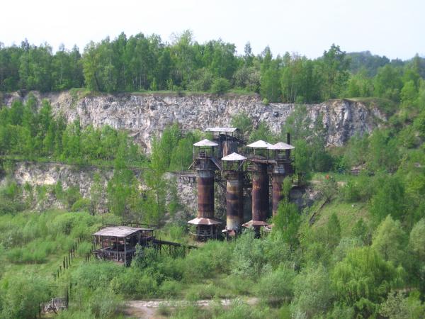


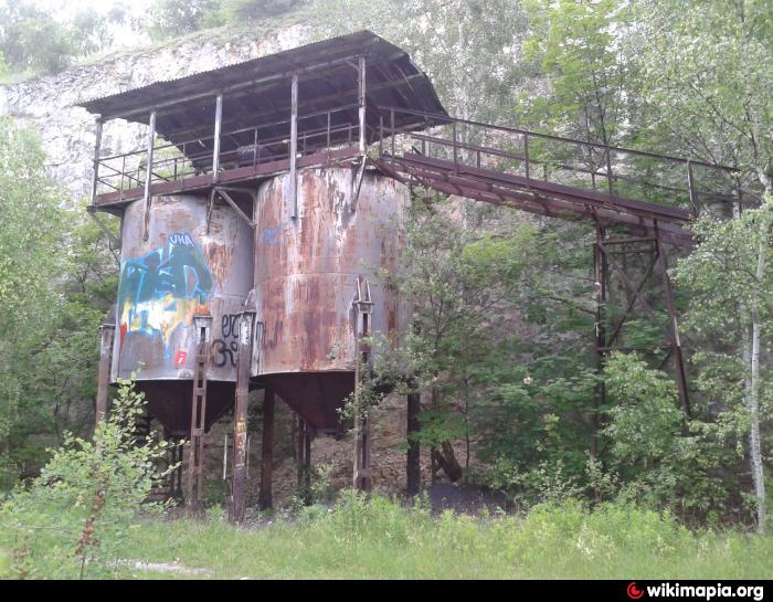
See surrounding quarry's article.
Nearby cities:
Coordinates: 50°2'12"N 19°57'21"E
- Kraków Spadzista site 4.8 km
- rail station Wieliczka-Square 9 km
- Old (former) shooting range 10 km
- Shooting range complex "Pasternik" 10 km
- Stary cmentarz parafialny 23 km
- Former Cereal Factory (PZZ) in Kozlow 49 km
- Abandoned windmill depot 147 km
- Were Object Research 154 km
- Meat Plants of Nisko Company 163 km
- Place of a former manor 196 km
- Kraków Liban Quarry (disused) 0.1 km
- Podgórze New Cemetery 0.4 km
- Municipal Waterworks 0.5 km
- Podgorze Jewish Cemetery (old) 0.6 km
- Podgórze New Jewish Cemetery (Abraham's) 0.8 km
- Payed Parking Zone P5 0.8 km
- Site of Kraków-Płaszów German Concentration Camp 0.9 km
- Wola Duchacka Bus Depot 1.3 km
- District No. XI, Podgórze Duchackie 2.8 km
- District No. XIII, Podgórze 4.3 km
Kraków Liban Quarry (disused)
Podgórze New Cemetery
Municipal Waterworks
Podgorze Jewish Cemetery (old)
Podgórze New Jewish Cemetery (Abraham's)
Payed Parking Zone P5
Site of Kraków-Płaszów German Concentration Camp
Wola Duchacka Bus Depot
District No. XI, Podgórze Duchackie
District No. XIII, Podgórze