vulytsia Sumska, 134 (Kharkiv)
Ukraine /
Kharkivska /
Kharkiv /
vulytsia Sumska, 134
World
/ Ukraine
/ Kharkivska
/ Kharkiv
, 7 km from center (Харків)
World / Ukraine / Kharkiv
invisible, do not draw title, fenced area
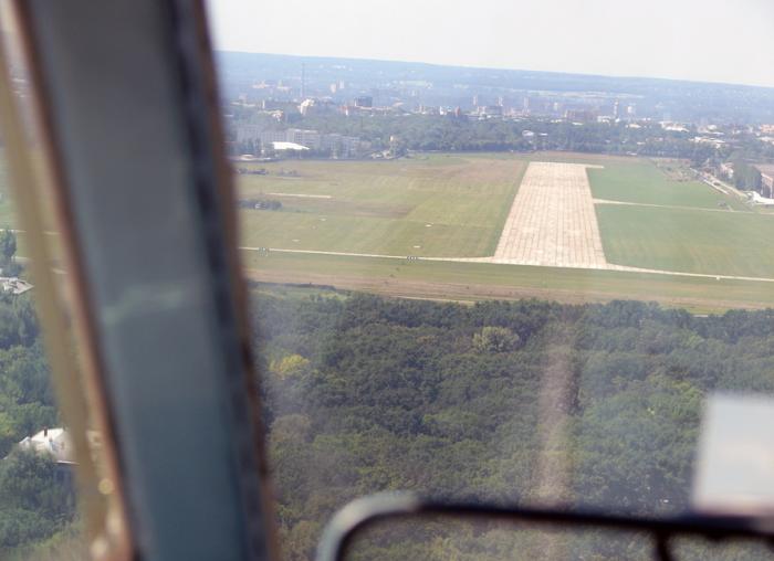
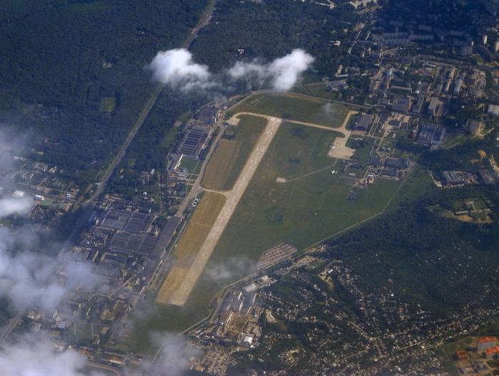
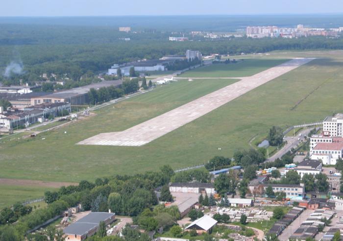
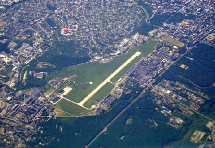
Kharkiv-North (Kharkiv-Sokolnyky) International Airport Kharkiv
ICAO: UKHV
IATA: none
Elevation AMSL: 600 ft / 183 m
The history of Ukrainian civil aviation started in Kharkiv in 1923, when joint-stock society “Ukrvozduhput” was founded.
This airport was built in 1923 as a central passenger and cargo airport.
In 1924 the first passenger flights of “Ukrvozduhput” were opened:
Kharkiv – Poltava – Kyiv,
Kharkiv – Kirovohrad – Odesa.
Then in 1928 the first international flights to Teheran were opened here.
In 1941-1945 it was served as a military airfield, and was called Kharkiv-Central.
The Kharkiv-North airport is located on the territory of the Kharkiv State Aircraft Manufacturing plant in the historic district of Sokolnyky (also called Sokilnyky), and is used for civil and experimental aircrafts.
It is the site of factory airfield GAZ 135 (Kharkiv APO).
Early Tupolev jetliners were built here, and later the Antonov An-72 and An-74.
A development of the production of aircrafts in Sokolnyky demanded a new area for the main civil airport. It was constructed in 12 km south from the center of the city behind Osnova neighborhood, and started operations in 1932 with the name Osnova Airport (now – Kharkiv International Airport).
Since the 1990s, Kharkiv-North International Airport has been used again as an airport for passenger flights to Germany and to the Middle East, including charters.
Wikipedia article: http://en.wikipedia.org/wiki/Kharkiv_North_Airport
Nearby cities:
Coordinates: 50°1'28"N 36°16'5"E
- Zhuravlivka 1.3 km
- vulytsia Sumska, 134 1.5 km
- Sokilnyky 2.5 km
- Shyshkivka 2.5 km
- Pomirky 2.6 km
- Shatylivka 3.5 km
- Lytvynivka (Zhukovskoho Settlement) 4 km
- Pavlove Pole 5.3 km
- Sarzhyn Yar Ravine 6.7 km
- Shevchenkivskyi district 10 km
- Museum of Kharkiv State Aircraft Manufacturing Company 0.3 km
- Cemetery No. 13 0.8 km
- Tetra Sports Club 1 km
- Football Ground 1.2 km
- Archery range 1.3 km
- Green Area 1.4 km
- Sokilnyky-Pomirky Botanical Natural Monument of Local Significance 1.6 km
- Sokilnytske Lake 1.8 km
- Sarzhyn Yar Ravine 3.5 km
- Lisopark ('Forest Park') 4.2 km