Nrnadzor
Armenia /
Syunik /
Meghri /
World
/ Armenia
/ Syunik
/ Meghri
World / Armenia
village
Add category
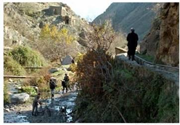
Nrnadzor is a town in the Syunik Province of Armenia.It was a former Muslim-habited village. In the XIX century, it is referred to as "Tat".
Now it is populated by Armenian refugees from Azerbaijan. The modern Armenian name Nrnadzor ("Pomegranate Gorge"), until 1988 was called Nyuvadi. In the village, there are gardens of pomegranate and figs. The National Statistical Service of the Republic of Armenia (ARMSTAT) reported its population was 140 in 2010,
Now it is populated by Armenian refugees from Azerbaijan. The modern Armenian name Nrnadzor ("Pomegranate Gorge"), until 1988 was called Nyuvadi. In the village, there are gardens of pomegranate and figs. The National Statistical Service of the Republic of Armenia (ARMSTAT) reported its population was 140 in 2010,
Wikipedia article: https://en.wikipedia.org/wiki/Nrnadzor
Nearby cities:
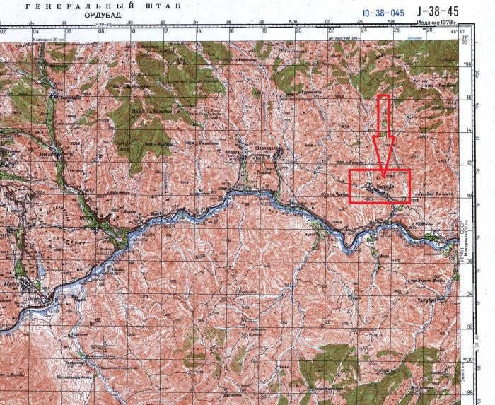
Coordinates: 38°54'59"N 46°26'32"E
- Plane Grove State Sanctuary 13 km
- Ruins of Bartaz 17 km
- Rezdere 19 km
- Վան գյուղի գյուղատնտեսական դաշտերը 29 km
- Syunik 33 km
- Xanlıq 47 km
- Chaytumas 50 km
- Bala Soltanly 54 km
- Ruins of Kavdar 69 km
- Amirvarli 69 km
- Mount Sevakar 2.2 km
- Jghasar mt. 3 km
- Arevik National Park 6.7 km
- Sigirt, 1371 mt. 7.2 km
- Bartaz mt. 7.7 km
- Azerbaijani border post. 8.3 km
- Agbend 12 km
- Meghri Municipality 14 km
- Zangilan district 24 km
- Marz of Syunik 54 km