Lommel Sahara (Lommel)
Belgium /
Limburg /
Lommel
World
/ Belgium
/ Limburg
/ Lommel
interesting place
Add category


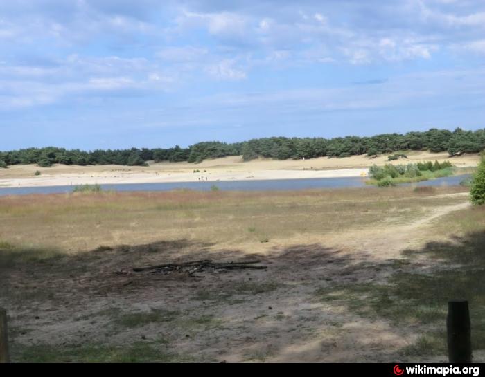
Sand dune and with a size of 193 hectares in the Belgian municipality of Lommel. In the middle is a lake and surrounding pine forests are found. This landscape is part of the Regional Landscape Low Kempen. Lommel Sahara is located in the immediate vicinity of the Kempen channel over which the pedestrian bridge forms a gateway to the sandy area.
Source Wikipedia.nl]
Source Wikipedia.nl]
Nearby cities:
Coordinates: 51°14'50"N 5°17'34"E
- BR-3 14 km
- Evoluon 24 km
- Grote Markt 25 km
- Eindhoven railway station 25 km
- Turnhout 28 km
- Museum Wings of Liberation 32 km
- Lion exhibit 33 km
- Drop Zone B, 502st PIR, 101st ABN DIV 17 September 1944 34 km
- Drop Zone C, 506st PIR, 101st ABN DIV 17 September 1944 34 km
- Pius haven 37 km
- Foot bridge 0.9 km
- De Soeverein 0.9 km
- Stedelijk Sportstadion 1.3 km
- Bridge, Gestelsedijk 1.5 km
- Center Parcs Vossemeren Lommel 2.3 km
- Bridge, Slinkerstraat 3 km
- Elongated farmhouse 4.1 km
- Bergeijk 8.8 km
- Pelt 10 km