Farol de Itapuã (Salvador)
Brazil /
Bahia /
Lauro de Freitas /
Salvador
World
/ Brazil
/ Bahia
/ Lauro de Freitas
Mundo / Brasil / Bahia / Salvador
farol, 1873_construction (en)
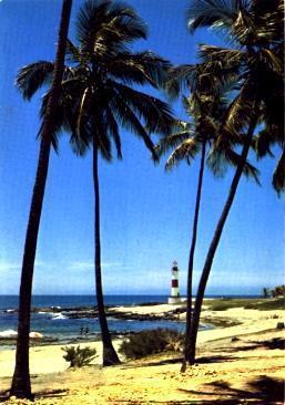
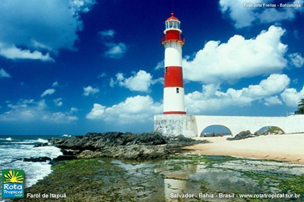
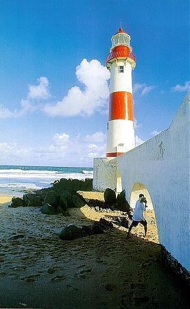
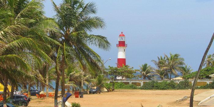
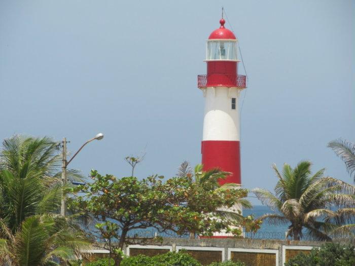
Farol de Itapuã is the 5th lighthouse built in Bahia state and 42nd in Brasil. It was constructed in December of 1873 by engineer Zosima Braulio Barroso.
The lighthouse has 21 meters height and can be seen from the distance of 15 nautical miles (28 km). Itapuã area is surrounded by reefs and the lighthouse helpted to vessels to escape the poosible risk of damage and sinking. The lighthouse tower was already painted in purple, then it was recolored in white and orange, and finally, since the 50s, the tower has is actual red and white pattern.
The lighthouse operates and it's closed for tourists and visitors
Artigo da Wikipédia: http://pt.wikipedia.org/wiki/Farol_de_Itapuã
Cidades vizinhas:
Coordenadas: 12°57'25"S 38°21'13"W
- Antigo Farol (Farolândia) 262 km
- Farol da Coroa do Meio 264 km
- Farol de Maceió 466 km
- Farol de Santa Helena 709 km
- Farol de Baia da Traição - Paraíba - Brasil 794 km
- Farol Novo 1028 km
- Ilha Rasa (Farol) 1234 km
- Farol de Preguiças 1250 km
- Farol 1281 km
- Farol de São João Marinha do Brasil 1487 km
- Praia do Farol 0.6 km
- Loteamento Farol de Itapuã 0.6 km
- Campo de golfe do Quatro Rodas 1.1 km
- Praia de Itapuã 1.2 km
- Água Suja 1.9 km
- Itapuã 2 km
- Área de Proteção Ambiental das Dunas do Parque do Abaeté 2.2 km
- Praia de Stella Maris 3 km
- Stella Maris 4.3 km
- Miolo Central de Salvador 8.7 km
Comentários