Paramānanda Mission
India /
Bangla /
Memari /
World
/ India
/ Bangla
/ Memari
World / India / West Bengal / Barddhaman
school, hospital, library, garden, pharmacy, village, post office, fitness centre / center, interesting place
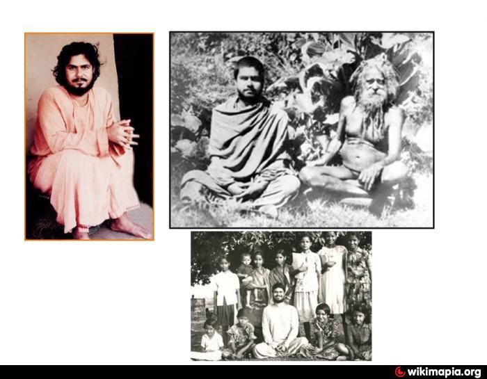
Established in the year 1978 and started with a very small plot of land donated by one of the devoted villagers to erect a tiny hut for Gurujī. Presently it covers a vast area of land with paddy fields all around centering the Mission.
The Mission pond with tall Debdaru trees, beautiful plants and colourful flowers add a charm to this scenic beauty. The cool and calm atmosphere free from any kind of pollution, the melody of the wind rattling on the leaves, chirping of the birds blended with the tune of cuckoos, is not only admirable but will make you realise the essence of love and enjoy the ever-flowing divine blessings of Gurujī.
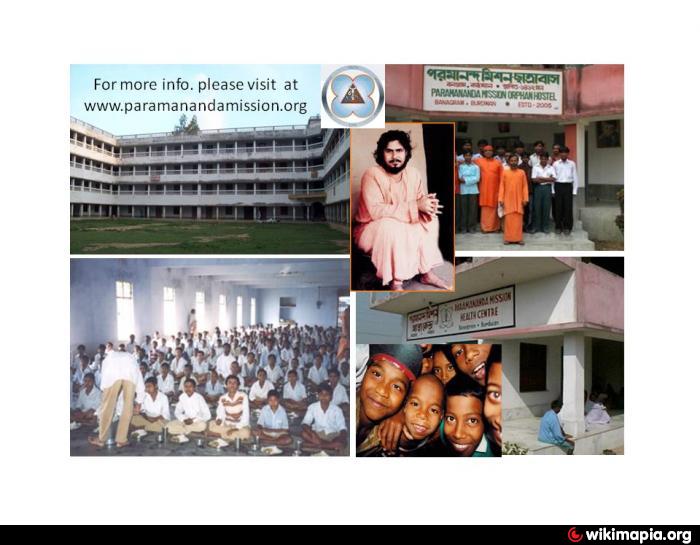
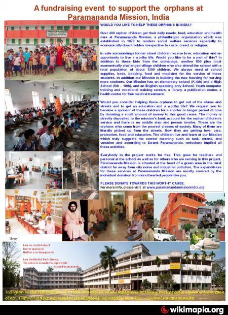
Paramānanda Mission is a spiritual organisation engaged in various activities especially in the field of destitute orphans and ill-fated down trodden masses. Motto of the Mission is to unveil the truth, that prevails based on sacrifice, peace, love, service and devotion in answering of the general people.
Presently there are more than 300 Orphans, which gets increased by 10% every year, who are getting their basic education in the Mission High School. Apart from the orphans there are around 125 monks and Brahmacāris and a regular visitors & devotees of around 500 on an average per day.
Devotees and visitors participate in the hours long spiritual discussions which are held twice a day in the morning and evening. They may stay at the Sādhanā Bhāwan for a few days and practise meditation through their respective “Art of Life and Art of Living” under a proper guidance.
Please visit the mission's site updated with recent picture in your leisure time: sites dealing with mission's service and other activities.
www.paramanandamissionindia.org
Direction From Kolkata (CALCUTTA) India.
By car:
From "Netaji Subhas Chandra Bose International Airport" Kolkata,
can get a prepaid taxi service to the Mission. Follow the
Sign of National Highway 2 (NH2), Cross the Ganga River via
Bally Bridge. After toll plaza, follow the sign of Durgapur Expressway
towards Bardhaman. Take Mamari exit and go towards Mamari.
After reaching Mamari follow the road going towards Paharhati.
From Paharhati take root towards Jabuiganda. From Jabuidanga
it is only 2 miles to Banagram Paramananda Mission.
By train and bus:
From "Netaji Subhas Chandra Bose International Airport" Kolkata,
can get a prepaid taxi service to the DumDum Train station or
Howrah station. Take the Main line local train to Bardhaman.
Getdown at Mamari station. After reaching Mamari get the taxi
or bus going towards Paharhati. From Paharhati take root towards
Jabuiganda. From Jabuidanga it is only 2 miles to Banagram
Paramananda Mission.
The Mission pond with tall Debdaru trees, beautiful plants and colourful flowers add a charm to this scenic beauty. The cool and calm atmosphere free from any kind of pollution, the melody of the wind rattling on the leaves, chirping of the birds blended with the tune of cuckoos, is not only admirable but will make you realise the essence of love and enjoy the ever-flowing divine blessings of Gurujī.
Paramānanda Mission is a spiritual organisation engaged in various activities especially in the field of destitute orphans and ill-fated down trodden masses. Motto of the Mission is to unveil the truth, that prevails based on sacrifice, peace, love, service and devotion in answering of the general people.
Presently there are more than 300 Orphans, which gets increased by 10% every year, who are getting their basic education in the Mission High School. Apart from the orphans there are around 125 monks and Brahmacāris and a regular visitors & devotees of around 500 on an average per day.
Devotees and visitors participate in the hours long spiritual discussions which are held twice a day in the morning and evening. They may stay at the Sādhanā Bhāwan for a few days and practise meditation through their respective “Art of Life and Art of Living” under a proper guidance.
Please visit the mission's site updated with recent picture in your leisure time: sites dealing with mission's service and other activities.
www.paramanandamissionindia.org
Direction From Kolkata (CALCUTTA) India.
By car:
From "Netaji Subhas Chandra Bose International Airport" Kolkata,
can get a prepaid taxi service to the Mission. Follow the
Sign of National Highway 2 (NH2), Cross the Ganga River via
Bally Bridge. After toll plaza, follow the sign of Durgapur Expressway
towards Bardhaman. Take Mamari exit and go towards Mamari.
After reaching Mamari follow the road going towards Paharhati.
From Paharhati take root towards Jabuiganda. From Jabuidanga
it is only 2 miles to Banagram Paramananda Mission.
By train and bus:
From "Netaji Subhas Chandra Bose International Airport" Kolkata,
can get a prepaid taxi service to the DumDum Train station or
Howrah station. Take the Main line local train to Bardhaman.
Getdown at Mamari station. After reaching Mamari get the taxi
or bus going towards Paharhati. From Paharhati take root towards
Jabuiganda. From Jabuidanga it is only 2 miles to Banagram
Paramananda Mission.
Nearby cities:
Coordinates: 23°16'36"N 88°4'25"E
- Purbasthali Lake & Bird Sanctuary 33 km
- Mayapur 37 km
- Sriniketan 62 km
- Visva-Bharati 63 km
- Baharampur 97 km
- Tarapith 98 km
- Bankibera Dam 118 km
- Kairabuni Dam 120 km
- Hizla 140 km
- Sadhur Mor Godagari Rajshahi 143 km
- SAMANTI 1.7 km
- Paharhati 4 km
- Jotram 6.5 km
- Begunia 6.5 km
- SIJNA VILL SANTOSH 11 km
- Inath Nagar 12 km
- Maynampur village 13 km
- Kamra 13 km
- TAJPUR 13 km
- Rai Gram 17 km
Comments