Twyfelfontein - UNESCO World Heritage Site
Namibia /
Kunene /
Khorixas /
World
/ Namibia
/ Kunene
/ Khorixas
World / Namibia / Kunene
memorial, interesting place, UNESCO World Heritage Site


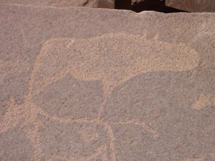
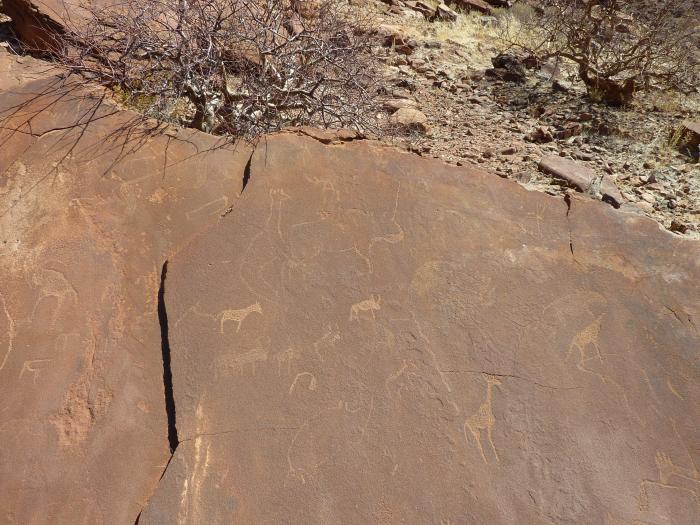
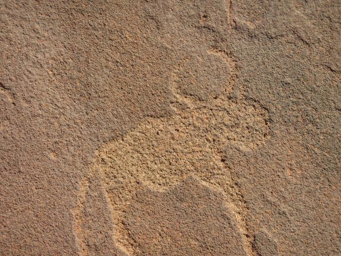
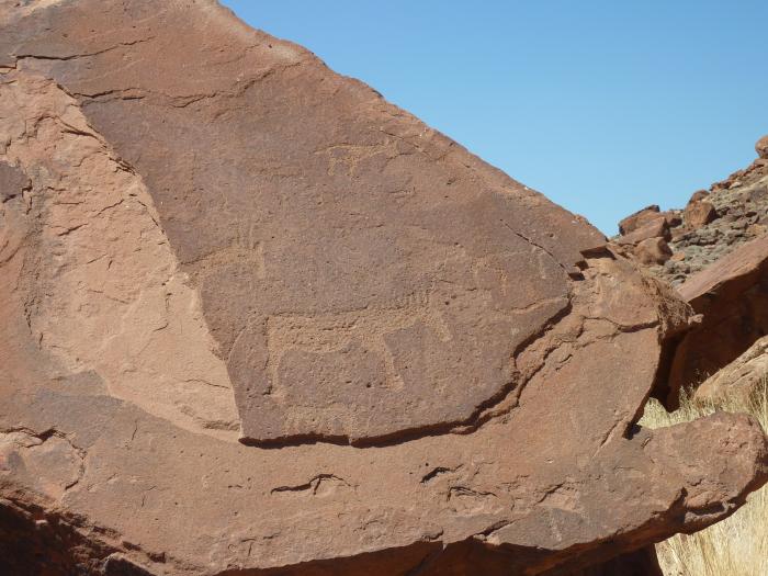
Twyfelfontein has one of the largest concentrations of rock petroglyphs (engravings) in Africa. Most of these well-preserved engravings represent rhinoceros, elephant, ostrich and giraffe, as well as drawings of human and animal footprints. The site also includes six painted rock-shelters with motifs of human figures in red ochre. The objects excavated from two sections, date from the Late Stone Age. The site forms a coherent, extensive and high-quality record of ritual practices relating to hunter-gatherer communities in this part of southern Africa over at least 2,000 years.
Wikipedia article: http://en.wikipedia.org/wiki/Twyfelfontein
Nearby cities:
Coordinates: 20°35'36"S 14°22'28"E
- Mount Etjo 218 km
- Klein Namutoni (Little Namutoni) 334 km
- Otjinene 461 km
- Highway Mountain of Leba 627 km
- Serra da Leba 628 km
- Popa Falls 806 km
- kilombo de ndalatando 1255 km
- Matende Mission 1786 km
- Oklo mine 2145 km
- Origin of Geographic Coordinate System - Latitude 0° / Longitude 0° 2794 km
- Doros Crater 19 km
- Brandberg Mountain 63 km
- Goboboseb 78 km
- Uis 89 km
- Messum Crater 93 km
- Fransfontein Mountain Range 133 km
- Spitzkoppe 161 km
- Omatako Mountain 254 km
- Ombotozo 280 km
- EPL 2410 292 km