Stockton Beach
Australia /
New South Wales /
Lemon Tree Passage /
World
/ Australia
/ New South Wales
/ Lemon Tree Passage
beach, dunes, dirt bike track


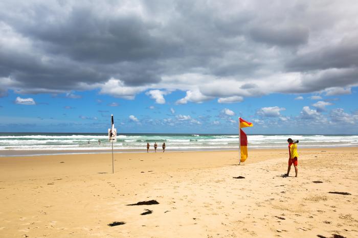
Stockton Beach is a 32 kilometre long beach just north of Newcastle on the New South Wales east coast. The beach is popular with four wheel drivers and motorcyclists.
There are tour companies operating on the beach as well as horse and camel rides.
Entrance to the beach is from Lavis Lane (Williamtown) at the south, or Anna Bay at the north. A beach permit is required for any vehicle entering the beach which can be obtained at the Metro Service Station on Lavis Lane or the BP Service Station at Anna Bay. Cost varies depending on how long your pass is valid for (weekend, week or year).
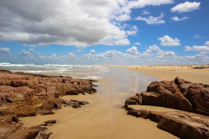
The dunes on Stockton are the big draw card. Some of them are over 30 metres tall. Other points of interest is Tin City; an collection of old fishing huts just over the first dune about midway down the beach. Also the wreck of the Sygna at the southern end of the beach is very interesting. More information is available on Wiki.
As of 2008, parts of the beach are being closed down. The Anna Bay end of the beach has been roped off to prevent vehicular access to the northern most dunes. Further down (around the Sygna) have also been roped off.
The beach used to be maintained by the New South Wales Parks and Wildlife but has been handed back to the traditional owners, the Worimi people. Driving along the beach you will see countless middens which are exposed over time. This beach is actually the largest moving sand mass in the Southern Hemisphere.
There are tour companies operating on the beach as well as horse and camel rides.
Entrance to the beach is from Lavis Lane (Williamtown) at the south, or Anna Bay at the north. A beach permit is required for any vehicle entering the beach which can be obtained at the Metro Service Station on Lavis Lane or the BP Service Station at Anna Bay. Cost varies depending on how long your pass is valid for (weekend, week or year).
The dunes on Stockton are the big draw card. Some of them are over 30 metres tall. Other points of interest is Tin City; an collection of old fishing huts just over the first dune about midway down the beach. Also the wreck of the Sygna at the southern end of the beach is very interesting. More information is available on Wiki.
As of 2008, parts of the beach are being closed down. The Anna Bay end of the beach has been roped off to prevent vehicular access to the northern most dunes. Further down (around the Sygna) have also been roped off.
The beach used to be maintained by the New South Wales Parks and Wildlife but has been handed back to the traditional owners, the Worimi people. Driving along the beach you will see countless middens which are exposed over time. This beach is actually the largest moving sand mass in the Southern Hemisphere.
Wikipedia article: http://en.wikipedia.org/wiki/Stockton_Beach,_New_South_Wales
Nearby cities:
Coordinates: 32°49'46"S 151°56'20"E
- Seven miles beach 243 km
- Seven Mile Beach 483 km
- Tyagarah Nature Reserve 501 km
- Pottsville / Beach 519 km
- Kingscliff 533 km
- Godwin Beach 650 km
- Five Mile Beach 840 km
- Venus Bay 2nd Estate 855 km
- Antechamber Bay 1316 km
- Browns Beach 1337 km
- Tilligerry State Conservation Area 10 km
- Tiligerry Peninsula 10 km
- Port Stephens Council 12 km
- Lemon Tree Passage 14 km
- Salamander Bay 18 km
- Port Stephens 19 km
- North Arm Cove 21 km
- Dark Point Aboriginal Place 37 km
- Bombah Broadwater 46 km
- MidCoast Council, NSW 85 km