Roman Harbour
Israel /
Haifa /
Qesarya /
World
/ Israel
/ Haifa
/ Qesarya
World / Israel
seaport, Roman Empire

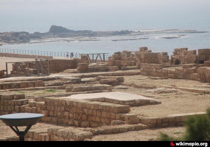
The Harbour at Caesarea was built by King Herod between 22 BC and 9 BC. It was one of the greatest engineering wonders of its time. It was the first major construction project to use concrete that would set under water. The length of the southern break water is 500 metres (1,600 ft). The length of the northern break water is 200 metres (660 ft). The largest stone block measures 5.5 metres (18 ft) by 1.25 metres (4.1 ft) by 1.25 meters (over 20 short tons (18 t)). The largest concrete block measures 11.5 meters by 15 metres (49 ft) by 2.4 metres (7.9 ft). The concrete blocks were created by floating a form on the water and filling it with concrete, as it filled up it would sink into place and the concrete would set under water.
australis.www2.50megs.com/caesarea/mole.html
greekreporter.com/2021/07/09/byzantine-coins-uncovered-...
australis.www2.50megs.com/caesarea/mole.html
greekreporter.com/2021/07/09/byzantine-coins-uncovered-...
Wikipedia article: http://en.wikipedia.org/wiki/Caesarea_Maritima
Nearby cities:
Coordinates: 32°30'13"N 34°53'21"E
- Caesarea Maritima 0.7 km
- Fortification Wall 407 km
- Sīrrūs/Cyrrhus/Qal‘at Nabī Hūrī 509 km
- Ruins of Anazarbus 538 km
- Mons Claudianus Quarries 648 km
- Sagalassos (Pisidian) 701 km
- Ancient Arzan 848 km
- Ancient Maronia 1254 km
- Byzantine Walls 1399 km
- Battle of Pydna (June 22, 168 BC) 1404 km
- Caesarea Industrial Park 5.9 km
- Ramat HaNadiv 7 km
- Givat Olga 7.6 km
- Fish Farms 7.7 km
- Beit Eliezer 11 km
- Alona Regional Council 14 km
- Hof HaCarmel Regional Council 16 km
- Menashe Regional Council 16 km
- Hefer Valley Regional Council 17 km
- Samaria 37 km