Rathong Peak (6,678m)
| mountain, summit
India /
Sikkim /
Gezing /
World
/ India
/ Sikkim
/ Gezing
World / Nepal / East / Mechi / Taplejung
mountain, summit
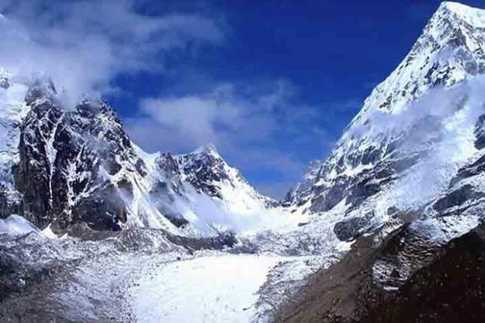
It rises in the Indo-Nepal boarder (Coordinates 27°35'36"N 88°5'12"E).It is directly connected with Kanchejhonga South peak through Kabru North-South-IV-Talung peaks.In the north side of the peak is in Nepal and it rises from famous Yalung gl of Kanchenjhongha west.In the south there is rathong icefall & glacier.In the west Rathong La seperates it from Koktang group of peaks of Singhalia range.In the east and SE are Kabru Massif with less known avalanch peak.
Climbing History:: It was climbed in 1963 Indian pre-Everest team of strong Indian Army with two civilians.They put nine members atop from the Yalung side. Some attempts by HMI advance courses failed.In 1992 a ladies team from Kolkata had an attempt but there poor experience costs a life of a Sherpa.Subsequent attempt by a team from Siliguri(NBEC) vide the expedition report of Durjoy Ghosh, leader, in Indian Mountaineer vol 39. The team was full of experienced members so expectation was very high.But after two successive attempts from Yalung glacierl. camp(Nepal side) they could not establish the summit camp.The feature of the region was completely changed due to global warming.The ice face was totally melt & rock face exposed for which the team was not prepared for.Moreover Tashi had a fall and got hurt in his hand & shoulder.The weather was alarming so the expedition was abandoned. The team reached nearly 20000 ft. While returning a life-time experience was witnessed by the team in the morning. Two glacial lakes busted in the quick succession in the rathong glacier area. The nerve racking sounds that accompanied by the huge water-ice slab flow in onside through faint Rathong Chu another one flown through the BC valley sweeping our kitchen gears and equipment. Perplexed! Frightened!! Good luck nobody is hurt..At about 3-30pm it calm down but the water stream was flowing beside tents all the day.All the bridges on rathong chu were blown away.to face great difficulties while our way back since small bridges were blown away on rathong chu.
Next major invasion to the Kabru Massif was conducted by a Indian army team under the leadership of Col.Goath .He was successful to climb Kabru N-S & Dome.Had an attempt to Rathong but failed.
A British pair Owen Samuel & Late Roger Payne made an attempt in alpine style to the peak from SW ridge in 2008.The route was through exposed rock & mixed snow with rocks.They reached upto 6200m app. but had to returned back due to strongwind.
Nearby cities:
Coordinates: 27°35'43"N 88°5'21"E
- Kangchenjunga Group of Peaks 13 km
- Mount Everest 125 km
- Thaptsa Peak 4000 m 145 km
- Parasnath Hill 443 km
- Mana Peaks 905 km
- Dudhātoli Dāndā 914 km
- Arwa Peaks 925 km
- Bharsār ka Daand 928 km
- Chandra Parbat Peaks 934 km
- Manda Peaks 960 km
- Yalung Glacier 6.2 km
- Talung Glacier 10 km
- Yamatari Glacier 11 km
- Tongshiong Glacier 13 km
- Kanchenjunga National Park 15 km
- south simvu glacier 17 km
- Lake Trek Destination 18 km
- Khangchendzonga National Park 22 km
- Sikkim 37 km
- Panchthar District 58 km