Ruins of Jewish Funeral Parlor (Kraków)
Poland /
Malopolskie /
Krakow /
Kraków /
ul. Abrahama
World
/ Poland
/ Malopolskie
/ Krakow
World / Poland / Lesser Poland
monument, ruins, funeral home, judaism, interesting place


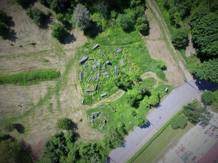
Overcrowding at the old Jewish cemetery led circa 1932 to creation of this new cemetery of several acres and mausoleums and a Modern-style funeral parlor designed by Adolf Siodmak.
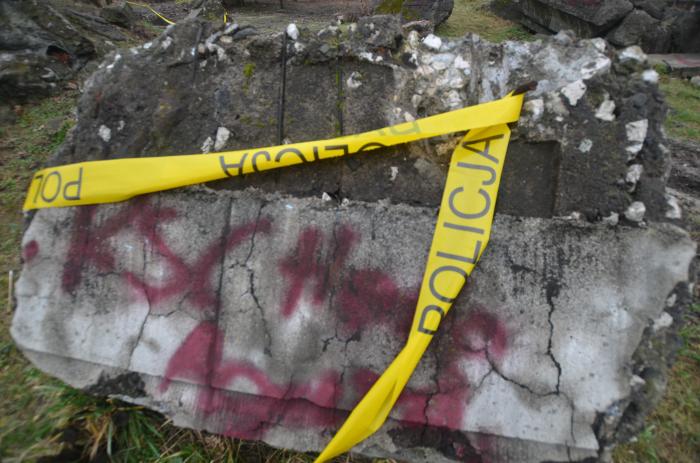
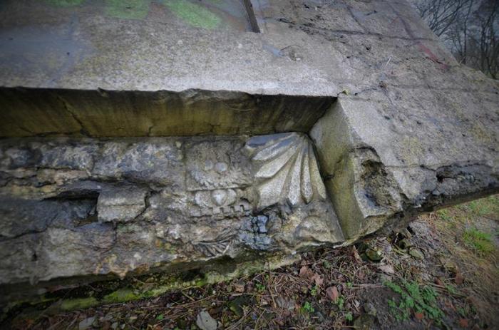
During the Nazi occupation in World War II, nearly all tombstones were stolen for use as road-pavement. The funeral parlor was gutted and used as a stable and pigsty.
After the war, the abandoned remnants continued to deteriorate.
Recently, the site which now belongs to the Jewish Community in Krakow was cleaned up. A memorial stone was erected.
Memorial stone photo credit : Zetpe0202
Nearby cities:
Coordinates: 50°2'0"N 19°57'56"E
- Podgórze New Jewish Cemetery (Abraham's) 0.3 km
- Artillery Battery Remnants 0.3 km
- H-hill execution site memorial 0.3 km
- Воинское кладбище № 386 — Подгуже 0.5 km
- Site of Kraków-Płaszów German Concentration Camp 0.6 km
- Krakus Mound 0.8 km
- Podgórze Old Cemetery 1.1 km
- Church of the Immaculate Conception 3.4 km
- The Botanic Garden of the Jagiellonian University 3.5 km
- University Hospital 3.8 km
- Podgorze Jewish Cemetery (old) 0.2 km
- H-hill execution site memorial 0.4 km
- Municipal Waterworks 0.4 km
- Podgórze New Cemetery 0.5 km
- Bonarka Nature Reservation Area 0.6 km
- Kraków Liban Quarry (disused) 0.7 km
- Wola Duchacka Bus Depot 1.1 km
- Payed Parking Zone P5 1.6 km
- District No. XI, Podgórze Duchackie 2.2 km
- District No. XIII, Podgórze 3.6 km