Ustye
Russia /
Vologda /
Ustye /
World
/ Russia
/ Vologda
/ Ustye
, 0 km from center (Устье)
World / Russia / Vologda
village, district center
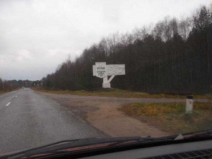

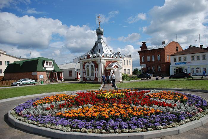


Ustye (Russian: У́стье), also known as Ustye-Kubenskoye (У́стье-Ку́бенское), is a rural locality (a selo) and the administrative center of Ust-Kubinsky District of Vologda Oblast, Russia, located on the banks of the Kubena River close to its confluence with Lake Kubenskoye. It also serves as the administrative center of Ustyansky Selsoviet, one of the ten selsoviets into which the district is administratively divided. Municipally, it is the administrative center of Ustyanskoye Rural Settlement. Until 2004, Ustye had urban-type settlement status. Population: 3,938 (2010 Census).
The area was populated by Finnic peoples and then colonized by the Novgorod Republic. Kamenny Monastery on Kamenny Island on Lake Kubenskoye was founded in 1260. In the 15th century, the area, known as Zaozyorye (translated as Trans-lake lands), for a short period became a principality, Principality of Zaozyorye, which was dependent on Principality of Yaroslavl. Before 1447, it became a part of the Grand Duchy of Moscow. It is not exactly known what was the capital of the principality but presumably it was located at the current location of Ustye. Ivan the Terrible visited the mouth of the Kubena in 1545. The selo of Ustye is known since 1570. Due to the location on one of the trading routes connecting the basins of the Northern Dvina and the Volga, and in the mouth of the Kubena, Ustye became a prosperous settlement living from trading. It was also a gateway for the pilgrims heading to Kamenny Monastery.[10] In the course of the administrative reform carried out in 1708 by Peter the Great, Zaozyorye was included into Archangelgorod Governorate. In 1780, Arkhangelogorod Governorate was abolished and transformed into Vologda Viceroyalty, and in 1796 the latter was split into Arkhangelsk and Vologda Governorates. Ustye became then part of Kadnikovsky Uyezd of Vologda Governorate. On July 15, 1929, the uyezds were abolished, the governorates merged into the Northern Krai, and Ust-Kubinsky District with the administrative center of Ustye was established among others. In 1932, Ustye became an urban-type settlement. In 2004 the status was revoked, and it became a selo again.
The area was populated by Finnic peoples and then colonized by the Novgorod Republic. Kamenny Monastery on Kamenny Island on Lake Kubenskoye was founded in 1260. In the 15th century, the area, known as Zaozyorye (translated as Trans-lake lands), for a short period became a principality, Principality of Zaozyorye, which was dependent on Principality of Yaroslavl. Before 1447, it became a part of the Grand Duchy of Moscow. It is not exactly known what was the capital of the principality but presumably it was located at the current location of Ustye. Ivan the Terrible visited the mouth of the Kubena in 1545. The selo of Ustye is known since 1570. Due to the location on one of the trading routes connecting the basins of the Northern Dvina and the Volga, and in the mouth of the Kubena, Ustye became a prosperous settlement living from trading. It was also a gateway for the pilgrims heading to Kamenny Monastery.[10] In the course of the administrative reform carried out in 1708 by Peter the Great, Zaozyorye was included into Archangelgorod Governorate. In 1780, Arkhangelogorod Governorate was abolished and transformed into Vologda Viceroyalty, and in 1796 the latter was split into Arkhangelsk and Vologda Governorates. Ustye became then part of Kadnikovsky Uyezd of Vologda Governorate. On July 15, 1929, the uyezds were abolished, the governorates merged into the Northern Krai, and Ust-Kubinsky District with the administrative center of Ustye was established among others. In 1932, Ustye became an urban-type settlement. In 2004 the status was revoked, and it became a selo again.
Wikipedia article: http://en.wikipedia.org/wiki/Ustye,_Ust-Kubinsky_District,_Vologda_Oblast
Nearby cities:
Coordinates: 59°37'44"N 39°43'33"E
- Vologda 37 km
- Cherepovets 129 km
- Rybinsk 179 km
- Kostroma 203 km
- Yaroslavl 206 km
- Ivanovo 293 km
- Bologoye 384 km
- Petrozavodsk 396 km
- Veliky Novgorod 499 km
- Vyborg 629 km
- Колхозная ул., 12 0.1 km
- Советская ул., 10-б 0.2 km
- ул. Лебедевой, 2 0.2 km
- Магазин 0.3 km
- Kubenskoye Lake 17 km