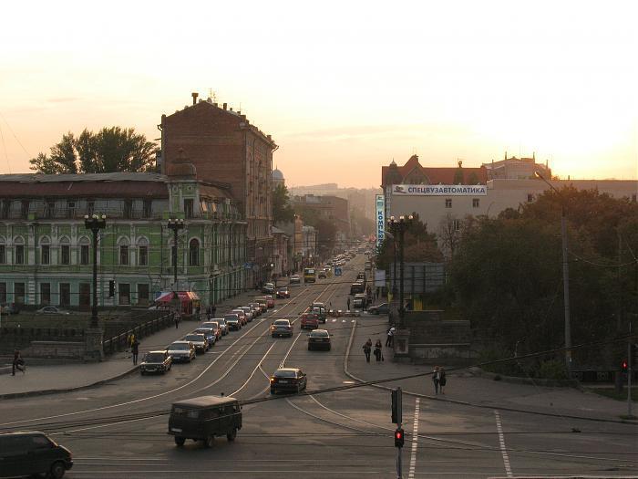
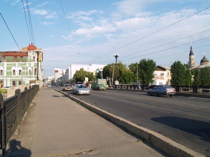
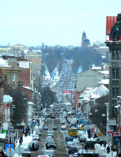
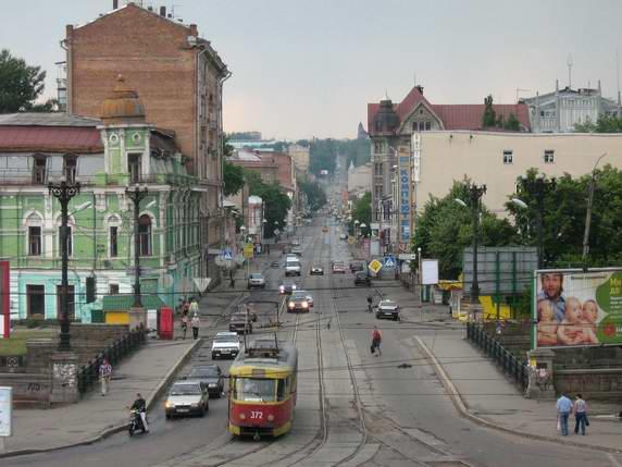
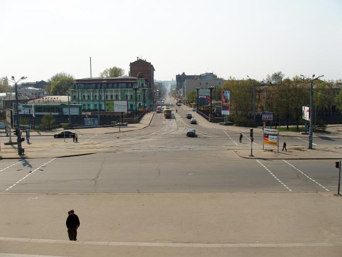
Poltavskyi Shliakh
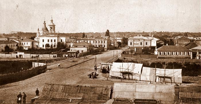
Poltavskyi Shliakh (Ukrainian: Полтавський Шлях) appeared in end of the 17th century as the road from Kharkiv to Poltava fortress – hence the name, which means 'Poltavian Way', 'Way to Poltava'.
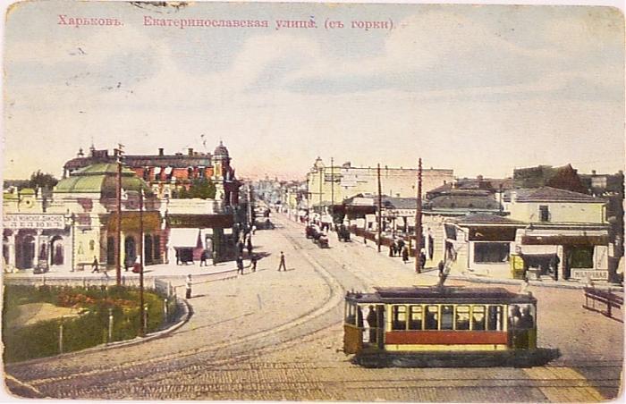
Until March 1919 and from June till December 1919 – vulytsia Yekaterynoslavska.
From March 1919 – vulytsia Sverdlova.
Since 1996 – Poltavskyi Shliakh again.
Poltavskyi Shliakh is one of the main streets, which connects the center of Kharkiv with the international highway M-03 (by Ukrainian classification), which is part of the European route E40 (Calais/FR — Ridder/KZ).
Poltavskyi Shliakh, related objects
- 1
- 1/3
- 2
- 3
- 4
- 5
- 5 - Кафе (ru)
- 6
- 6 - Bommer
- 7
- 8
- 9a
- 9
- 10
- 11 - Администрация Новобаварского района Харьковского городского совета (ru)
- 13/15 - ООО «Виккерс Энерджи» (ru)
- 13
- 14
- 15
- 16
- 17a
- 17
- 18 - Research Center of the cossacks of the name of hetman Mazepa
- 18 - Youth Theatre
- 19
- 20
- 21
- 22a
- 23/25
- 24б - Shishas rur (ru)
- 24
- 24в
- 24a
- 25
- 26
- 27
- 27
- 27 - Магазин «Турист» (ru)
- 28/19
- 29
- 30
- 31 - Poltavskyi Shliakh Business Center
- 32
- 33/18
- 33
- 34 - Реконструируемое здание 1-й клинической больницы: Поликлиническое отделение №1 (ru)
- 35
- 36
- 37
- 37
- 38
- 39
- 40/16
- 40
- 41
- 42
- 43
- 44 - Магазин женской одежды (ru)
- 44 - Sviato-Dmytrivskyi Temple ('Saint Demetrius Church')
- 45 - Court of Novobavarskyi District
- 46
- 47/49
- 48
- 48 - Кафе-кондитерская "Кулиничи" (ru)
- 50 - Харьковский районный отдел Управления МЧС в Харьковском районе (ru)
- 50 - Fire brigade
- 51
- 52 - Бывшая гостиница "Октябрьская" (ru)
- 53/55
- 53/55
- 54 - The Obstetric and Gynecological Branch of the Railway Clinical Hospital (Kharkiv Station of Southern Railway)
- 56
- 57/59
- 57 - Харьковский городской благотворительный фонд "АВЭК" (ru)
- 58/1 - McDonald's
- 60 - ТЦ "Грань" (ru)
- 62 - Магазины (ru)
- 65
- 67
- 67 - Ветеринарная клиника «Фауна-Сервис» (ru)
- 82/5
- 84
- 86
- 88
- 90
- 92
- 94
- 95/1
- 96
- 98
- 99 - Харьковский СИЗО (ru)
- 101
- 101а
- 106
- 108
- 110
- 112
- 114
- 114 - Общественный погреб - бомбоубежище (ru)
- 115
- 115 - Типография (ru)
- 115
- 115 - Холодногорский рынок (ru)
- 115 - Продуктовый маркет «Дигма» (ru)
- 116
- 118
- 119
- 121
- 123
- 123 - Магазин автозапчастей "ТЛ Авто" (ru)
- 124 - Свято-Озерянский храм (ru)
- 126
- 128
- 130/132
- 133
- 134 - Магазин «Шины» (в народе «Помидорчик») (ru)
- 134 - Аптека № 1617 (ru)
- 140a - Bath-house etc.
- 144
- 144 - Строительство ЖК «Полтавский Шлях 144» (ru)
- 146
- 147 - Горячие слойки, холодные напитки (ru)
- 148/2
- 148/2 - Торговый центр «Арго» (ru)
- 149д - Пересадочный терминал "Ст. м. «Холодная Гора»" (ru)
- 149 - Интернет-магазин "Леда-Агро" (ru)
- 152а
- 152
- 152 - Pharmacy & mineral water 'Simeyna', 24x7
- 152 - The "Regional Center of Clinical Dentistry"
- 152в - Ресторан "Пират" (ru)
- 152
- 152
- 152 - Bakery
- 153
- 153
- 154
- 155
- 155a
- 156
- 161
- 167
- 169
- 171
- 173
- 175
- 177
- 177а - Жилой дом (на месте заброшенного детсада) (ru)
- 177a block 1
- 177b - Nova Poshta ('New Post') Office No. 101
- 177a block 2
- 177a block 3
- 181а
- 181
- 181б - ЖК «Столичный» (ru)
- 184
- 188/9
- 188a
- 188a - Ремонт автостекол "СКА" (ru)
- 188a
- 188/11
- 188
- 188V
- 188/10
- 188/12
- 188/7
- 188/8
- 188/6
- 190/1
- 190/4
- 190/9
- 190
- 190/3
- 190
- 190/2
- 190/6
- 190
- 190/5
- 192 - Часовня Иоанна-воина (ru)
- 192
- 192 - vulytsia Poltavskyi Shliakh
- 196 - Yunist ('Youth') Park
- 207а
- 212a - Car repair X-Motors 2
- 247а - Холодногорский РЭС (ru)
- 247a - Substation 330/110/35 kV Zaliutyne
- Computer shop - Specvuzavtomatika
- Myslyteliv Public Garden
- Shoe repairs
- WC
- ЖЭК (ru)
- КП «Харьковпасс» (ru)
- Магазин "Кулиничи" (ru)
- Магазин-кафе «Кулиничи» (ru)
- Сквер им. проф. Мещанинова (ru)
- Строящееся здание (ru)
- Шиномонтаж "Шинный сервис" (ru)
Nearby cities:
Coordinates: 49°58'48"N 36°10'30"E
- Kholodna Hora 0.3 km
- Hryhorivske shose, 54 0.4 km
- Rubanivka 0.9 km
- Swamp 1.4 km
- Faris Safarov Public Garden 1.4 km
- Hryhorivskyi Pine Forest 1.7 km
- Zaliutyne railway station 1.7 km
- Hryhorivka 1.9 km
- Novoselivka 2.1 km
- Novobavarskyi district 3.1 km
- provulok Pershyi (1st) Zolochivskyi 1.8 km
- vulytsia Kytaienka 3.2 km
- prospekt Novo-Bavarskyi 3.6 km
- vulytsia Mykoly Lysenka 3.8 km
- vulytsia Sirykivska 3.8 km
- vulytsia Otakara Yarosha 6.3 km
- vulytsia Myroslava Mysly 7.4 km
- prospekt Liudviha Svobody 8.9 km
- prospekt Peremohy 9 km
- M-03 206 km