ulitsa Arbat (Moscow)


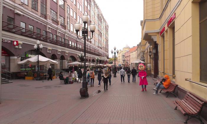
The Arbat Street.
The definite article has been historically used especially for this toponym (as in the Wall Street, the Mall).
The definite article has been historically used especially for this toponym (as in the Wall Street, the Mall).
ulitsa Arbat, related objects
Wikipedia article: http://en.wikipedia.org/wiki/Arbat_Street
Nearby cities:
Coordinates: 55°44'58"N 37°35'28"E
- Arbat Street
- Arbat District 0.2 km
- Polyclinic № 1 (President Administration Hospital) 0.2 km
- pereulok Sivtsev Vrazhek, 20 0.2 km
- 179th quarter of Arbat district 0.3 km
- Tsentralny Administrative Okrug 1.5 km
- Presnensky District 2.2 km
- Yakimanka District 2.3 km
- Khamovniki District 2.3 km
- Tverskoy District 2.4 km
- Mokhovaya ulitsa 1.3 km
- Druzhinnikovskaya ulitsa 1.4 km
- Zvenigorodskoye shosse 4.5 km
- Tretye Transportnoye Koltso 5.2 km
- Khlebobulochny proyezd 10 km
- ulitsa Akademika Chelomeya 10 km
- Starokaluzhskoye shosse 11 km
- ulitsa Akademika Volgina 12 km
- ulitsa Butlerova 12 km
- MKAD 17 km