Former Ada Kaleh island
Romania /
Mehedinti /
Ilovita /
World
/ Romania
/ Mehedinti
/ Ilovita
World / Romania
historical layer / disappeared object
Add category
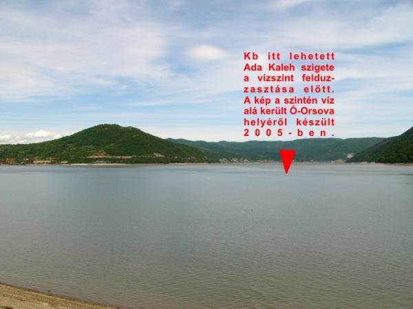


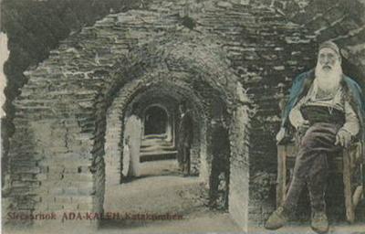
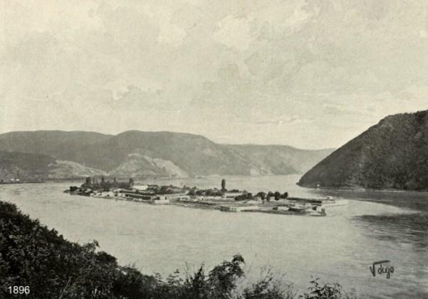
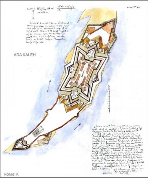

Former island, inhabitted by Turkish population, with mosque, now covered by the water, after the construction of the Iron Gates I dam at Turnu Severin - Gerdap.
Wikipedia article: http://en.wikipedia.org/wiki/Ada_Kaleh
Nearby cities:
Coordinates: 44°42'54"N 22°27'28"E
- Former Orşova location 3.6 km
- Hippodrome Preljina 186 km
- ex VJ 246 km
- Deva Chromp Mine 315 km
- Airport Tetovo 333 km
- Prosek / Stenae 369 km
- ex kasarna Luka Vukalovic 400 km
- Franz Joseph Island 405 km
- Mikra Livadia 414 km
- OLD TOWN 433 km
- Orşova South 4.7 km
- Jupalnic Forest 5.6 km
- Coramnic Forest 6.4 km
- Comuna Toplet 12 km
- Cazanele Mici (“The Small Kettles”) 15 km
- Cazanele Mari (“The Great Kettles”) 20 km
- Vatra Vechii Ogradene 22 km
- Iron Gates Gorge 24 km
- National park Đerdap 33 km
- Almaj Valley 40 km
Comments