Marsamxett Harbour
Malta /
Inner Harbour /
Floriana /
World
/ Malta
/ Inner Harbour
/ Floriana
World
harbour
Add category

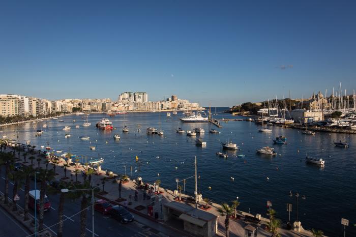


Marsamxett Harbour is the northern of Valletta's two natural harbours on the island of Malta, separated from the southern one (Grand Harbour) by the Valetta peninsular. To the north it is bounded by Gżira and Sliema as far as Dragut Point and extends inland to Pietà and Msida. It is generally more dedicated to leisure use than is Grand Harbour; there is a large yacht marina at Msida and tourist cruise boats operate from Sliema. Within the harbour and reached by a small bridge from Gzira, Manoel Island houses a yacht yard and the 18th century Fort Manoel.
Wikipedia article: http://en.wikipedia.org/wiki/Marsamxett_Harbour
Nearby cities:
Coordinates: 35°54'2"N 14°30'29"E
- Sukhoi Lyman ('Dry Estuary') 1779 km
- Abu Zenima 1899 km
- Prinses Arianehaven 1975 km
- Royal Saudi Naval Base Jeddah 2880 km
- Suakin 2909 km
- Bay Gyoltuk 3066 km
- Bandar-e Deylam Port 3371 km
- Al Mina 4005 km
- Gangavaram port limited/GPL 6981 km
- ASTARANGA PORT 7123 km
- Valletta 0.5 km
- Manoel Island 0.6 km
- Grand Harbour 1.3 km
- Senglea (L-Isla) 1.7 km
- French Creek 1.9 km
- Malta Shipyards Ltd. 2 km
- The Three Cities/Cottonera 2 km
- Xghajra 4 km
- Malta 5.4 km
- Malta Channel 49 km
Comments