Forty Mile, Yukon Territory, Canada (Ghost Town)
USA /
Alaska /
Eagle Village /
World
/ USA
/ Alaska
/ Eagle Village
World / United States / Alaska
ghost town
Add category
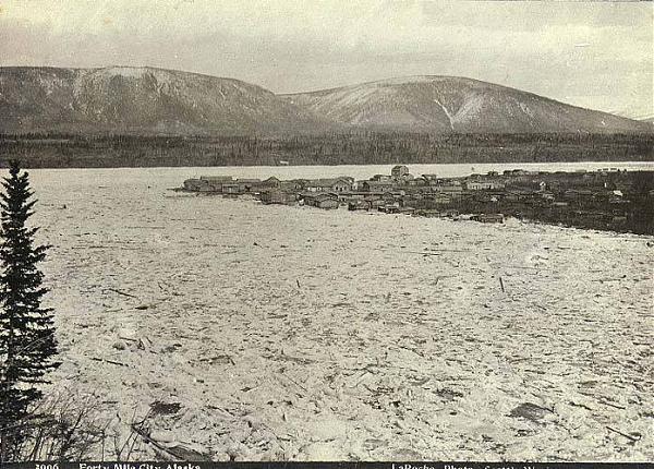
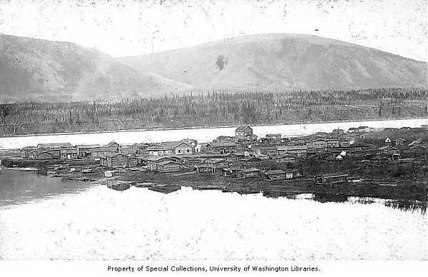
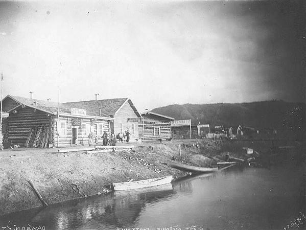
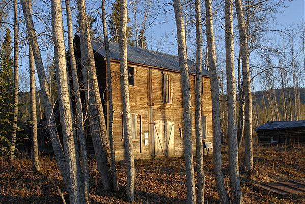
Forty Mile is best-known as the oldest town in Canada’s Yukon. The site is one of the most important sites in Yukon’s history. Fortymile was the location of a mining office where the Klondike gold strike claim was registered by George Carmack.
It was established in 1886 at the confluence of the Yukon River and Fortymile River by prospectors and fortune hunters in search of gold. Largely abandoned during the nearby Klondike Gold Rush, the town site continued to be used by Tr’ondëk Hwëch’in. It is currently a ghost town and historic site that’s co-owned and co-managed by Tr’ondëk Hwëch’in and the Government of Yukon.
www.yukonromance.ca/en/romance/uncertain/index.php?topN...
www.tc.gov.yk.ca/446.html
Excellent e-book: www.questia.com/PM.qst?a=o&d=51078148
Topo map: www.topozone.com/map.asp?lat=64.42106&lon=-140.56379&s=...
Wikipedia article: http://en.wikipedia.org/wiki/Forty_Mile,_Yukon
Nearby cities:
Coordinates: 64°25'14"N 140°32'32"W
- Clinton Creek, Yukon Territory, Canada (Ghost Town) 4.1 km
- Elsa 250 km
- Tofty, AK (site) 498 km
- Porcupine Creek Gold Mining Area 599 km
- Dikeman, Alaska (Ghost Town) 873 km
- Flat, Alaska (Ghost town) 894 km
- Candle, Alaska 1010 km
- Council, AK (Ghost town) 1098 km
- Ureliki 1554 km
- Korovinski, Alaska 2346 km
- Yukon - Forty Mile Confluence 0.9 km
- Mount Harper 43 km
- epicenter of m3.3 quake 61 km
- Mount Frank Rae 96 km
- CEZ2 Chapman Airport (Yukon) 121 km
- Epicenter of m3 quake 163 km
- Epicenter of m3.6 quake 166 km
- epicenter of m2.9 quake 182 km
- Eagle Plains, Yukon (approx location) 295 km
- epicenter of m4 quake 322 km
Comments