Interstate 75 Exit 49 - County Road 833
USA /
Florida /
Weston /
Interstate 75 (Alligator Alley), 49
World
/ USA
/ Florida
/ Weston
World / United States / Florida
invisible, highway interchange / exit
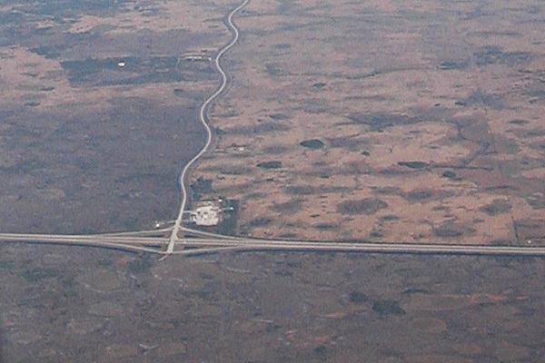
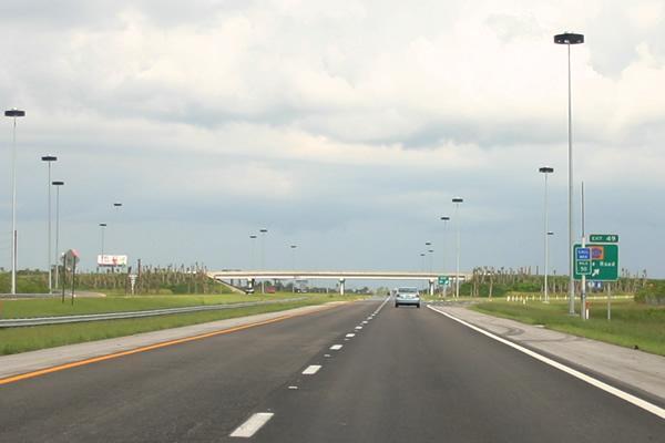
Leads to Broward County Road 833, also known as Snake Road, Government Road, or BIA Route 1281. Formerly known as Exit 14, before re-numbering took effect in 2002. It is 31 miles until the next exit, at State Road 29; but this is the only exit with a gas station and services along Alligator Alley.
www.copspy.com/FL/15396-alligator-alley.html
www.copspy.com/FL/15396-alligator-alley.html
Wikipedia article: http://en.wikipedia.org/wiki/Interstate_75_in_Florida
Nearby cities:
Coordinates: 26°10'15"N 80°51'23"W
- Biscayne Bay 68 km
- Cape Sable 97 km
- Florida Bay 108 km
- Bimini Islands 158 km
- Key West National Wildlife Refuge 213 km
- Cay Sal Bank 226 km
- Santaren Channel 263 km
- Nicholas Channel 297 km
- Florida Canyon 387 km
- Bay of Pigs 435 km
- Miccosukee Indian Reservation 6.1 km
- Big Cypress Seminole Indian Reservation 18 km
- Water Conservation Area 3A North 23 km
- Rotenberger Wildlife Management Area 26 km
- Holey Land Wildlife Management Area 27 km
- Water Conservation Area 3A South 31 km
- Big Cypress National Preserve 34 km
- Broward County, Florida 38 km
- Water Conservation Area 2A 47 km
- Palm Beach County, Florida 66 km
Miccosukee Indian Reservation
Big Cypress Seminole Indian Reservation
Water Conservation Area 3A North
Rotenberger Wildlife Management Area
Holey Land Wildlife Management Area
Water Conservation Area 3A South
Big Cypress National Preserve
Broward County, Florida
Water Conservation Area 2A
Palm Beach County, Florida