Burned Dodge - M*A*S*H Ambulance
USA /
California /
Agoura Hills /
World
/ USA
/ California
/ Agoura Hills
World / United States / California
ambulance station, interesting place, movie / film / TV location
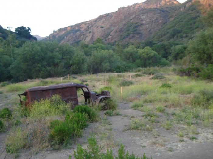
Burned during a brush fire which shut down filming of the final episode.
Wikipedia article: https://en.wikipedia.org/wiki/Dodge_WC54
Nearby cities:
Coordinates: 34°5'47"N 118°44'41"W
- Avenal District Hospital 248 km
- American Medical Responce Alameda County Operations 505 km
- Airlift Northwest 1526 km
- BCAS Vancouver Island Administrative Office 1643 km
- City of Calgary NE Multiservices Center 1930 km
- Combined service: Police / Fire / Ambulance Station 1937 km
- KCFD EMS Division / Former MAST Ambulance Headquarters 2228 km
- Sanford Ambulance 2323 km
- Columbia Heights Public Safety Building 2489 km
- WFPS Station 1 2490 km
- Malibu Creek State Park/20th Century Fox Ranch 1.7 km
- Paramount Ranch 3 km
- Agoura Hills Historic Quarter 4.9 km
- Rocky Oaks 6.6 km
- Morrison Ranch 7.2 km
- Saddlerock Ranch 7.7 km
- Santa Monica Mountains National Recreation Area 8.6 km
- Westlake Lake 9 km
- Cheeseboro and Palo Commado Canyon 9 km
- Los Angeles County, California 45 km