Southern Pacific Railroad Oakland Mole (Oakland, California)
USA /
California /
Emeryville /
Oakland, California /
Middle Harbor Road
World
/ USA
/ California
/ Emeryville
World / United States / California
mole, historical layer / disappeared object, closed railways
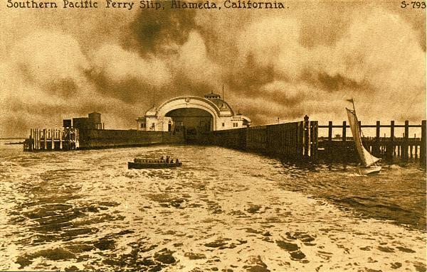
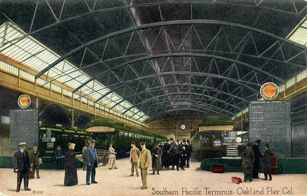
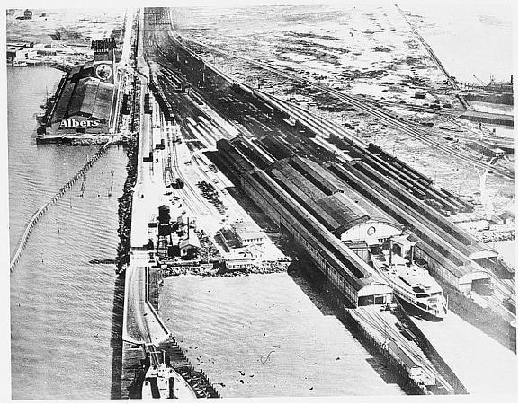
The Oakland Long Wharf, later known as the Oakland Pier or the SP Mole was a massive railroad wharf and ferry pier in Oakland, California. It was located at the foot of Seventh Street.
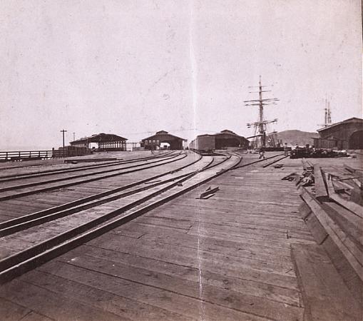
The pier began as a smaller ferry pier extending from Oakland Point westward into San Francisco Bay. In 1868, the Central Pacific Railroad acquired this pier and immediately began extending and improving it and renamed it the Oakland Long Wharf. This wharf was used by the CPRR for transporting freight cars over to San Francisco starting in 1871. Part of the wharf was filled in between 1879 and 1882, thus creating a mole. Local commuter trains also used the pier, while the transcontinental railroad trains used another wharf in nearby Alameda until 1876 when they were shifted to the Oakland Long Wharf. Thereafter, ferries carrying both commuters and long distance travelers operated between the Long Wharf and San Francisco. Beginning on January 15, 1939, electric commuter trains from East Bay points no longer ran to the Long Wharf (by then known as the SP Mole or, officially by the Southern Pacific, as Oakland Pier). Instead, they operated over the San Francisco-Oakland Bay Bridge to the Transbay Terminal in San Francisco. However, regular passenger trains continued to run to Oakland Pier until 1958, when the last Southern Pacific ferryboat service from the Ferry Building in San Francisco to Oakland Pier was discontinued. After that, service from San Francisco was by bus over the Bay Bridge to Oakland's 16th Street Station.
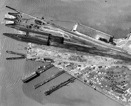
After the Central Pacific's operations were consolidated under the Southern Pacific, the Long Wharf was improved and the terminal buildings at the end of the pier rebuilt. Throughout its existence, progressively greater portions of the bayshore tidelands were filled in. The pier remained in service until 1958. It was demolished in the 1960s to make way for an expansion of the burgeoning Port of Oakland's container ship facilities. Today, the only thing that remains of the SP Mole is the switchman's tower, which was restored as part of a small commemorative park, and small stretch of rails submerged under asphalt along the waterline.
www.snowcrest.net/marnells/oakpier.htm
The pier began as a smaller ferry pier extending from Oakland Point westward into San Francisco Bay. In 1868, the Central Pacific Railroad acquired this pier and immediately began extending and improving it and renamed it the Oakland Long Wharf. This wharf was used by the CPRR for transporting freight cars over to San Francisco starting in 1871. Part of the wharf was filled in between 1879 and 1882, thus creating a mole. Local commuter trains also used the pier, while the transcontinental railroad trains used another wharf in nearby Alameda until 1876 when they were shifted to the Oakland Long Wharf. Thereafter, ferries carrying both commuters and long distance travelers operated between the Long Wharf and San Francisco. Beginning on January 15, 1939, electric commuter trains from East Bay points no longer ran to the Long Wharf (by then known as the SP Mole or, officially by the Southern Pacific, as Oakland Pier). Instead, they operated over the San Francisco-Oakland Bay Bridge to the Transbay Terminal in San Francisco. However, regular passenger trains continued to run to Oakland Pier until 1958, when the last Southern Pacific ferryboat service from the Ferry Building in San Francisco to Oakland Pier was discontinued. After that, service from San Francisco was by bus over the Bay Bridge to Oakland's 16th Street Station.
After the Central Pacific's operations were consolidated under the Southern Pacific, the Long Wharf was improved and the terminal buildings at the end of the pier rebuilt. Throughout its existence, progressively greater portions of the bayshore tidelands were filled in. The pier remained in service until 1958. It was demolished in the 1960s to make way for an expansion of the burgeoning Port of Oakland's container ship facilities. Today, the only thing that remains of the SP Mole is the switchman's tower, which was restored as part of a small commemorative park, and small stretch of rails submerged under asphalt along the waterline.
www.snowcrest.net/marnells/oakpier.htm
Wikipedia article: http://en.wikipedia.org/wiki/Oakland_Long_Wharf
Nearby cities:
Coordinates: 37°48'31"N 122°19'38"W
- Oakland-Berkeley Hills Firestorm Site 10 km
- Lake Chabot Machine Gun Range (site) 21 km
- Camp Stoneman (site) 42 km
- Capell 73 km
- Hamilton Training Annex (site) 120 km
- Gold Dredging Area (former site) 128 km
- Walerga Collection Center/Camp Kohler (sites) 129 km
- Gold Dredging Area 129 km
- Gold Dredging Area 132 km
- Area of Gold Dredging 136 km
- Middle Harbor 0.6 km
- Oakland Terminals 1.4 km
- Acorn Industrial 1.5 km
- Oakland APM Terminals - berths 20 to 24 1.8 km
- San Francisco-Oakland Bay Bridge 2 km
- South Prescott 2.4 km
- Desert Yard 2.6 km
- Prescott 2.7 km
- Alameda Point 3.1 km
- San Francisco Bay 11 km
Comments