USA /
New York /
Inwood /
New York City, New York


Morris Heights (New York City, New York)
World / USA / New York / Inwood World / United States / New York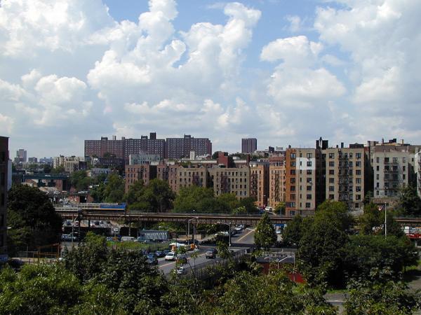
Morris Heights is a neighborhood in the Southwest Bronx. It is surrounded by the Cross Bronx Expressway to the south, the Harlem River to the west, Burnside Avenue to the north, and Jerome Avenue to the east. The local subway is the IRT Jerome Avenue Line, operating along Jerome Avenue. ZIP codes include 10453 and 10452. The area is patrolled by the 46th Precinct located at 2120 Ryer Avenue in Fordham. New York City Housing Authority (NYCHA) property in the area is patrolled by P.S.A. 7 at 737 Melrose Avenue in the Melrose section of the Bronx.
The main thoroughfare is University Avenue (Dr. Martin Luther King Jr. Blvd). Most of the shops are located along this thoroughfare between Featherbed Lane and West Tremont Avenue. Metro-North has a stop in Morris Heights underneath the River Park Towers residential complex. However, the nearest subway is the 4 train located down the hill at the 176th Street station.
The neighborhood is mixed with African-Americans who lived in the area for decades and Dominicans who recently moved across the bridge from Washington Heights. According to New York Magazine, Morris Heights has been called the "Next Boro Park".
Categories: neighbourhood, draw only border
Wikipedia article: http://en.wikipedia.org/wiki/Morris_Heights,_Bronx
Nearby cities:
Coordinates: 40°51'5"N 73°55'2"W
- Harlem (Manhattan, NY) 4.1 km
- Astoria 7.3 km
- Sunnyside 11 km
- Greenpoint 13 km
- Williamsburg 14 km
- Bushwick 16 km
- Stuyvesant Heights 17 km
- East New York 17 km
- Canarsie 22 km
- Bensonhurst 25 km
- Highbridge Park 0.9 km
- Fort Tryon Park 1.8 km
- Inwood Hill Park 2.4 km
- Palisades Interstate Park, New Jersey Section 3.8 km
- Englewood Cliffs, New Jersey 4.6 km
- Fort Lee, New Jersey 4.7 km
- The Bronx 6.4 km
- Manhattan 9 km
- The Palisades 13 km
- Westchester County, New York 34 km