Sabalan Mountain Range
Iran /
Ardabil /
Meshkinshahr /
World
/ Iran
/ Ardabil
/ Meshkinshahr
, 28 km from center (مشگين شهر)
World / Iran / Ardebil
invisible, mountain range
wikipedia:
(4811 m.)
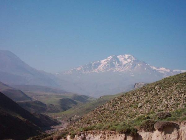
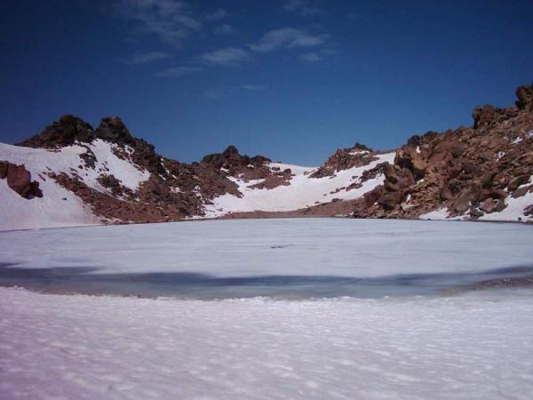
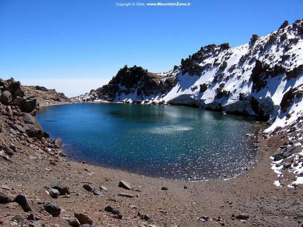
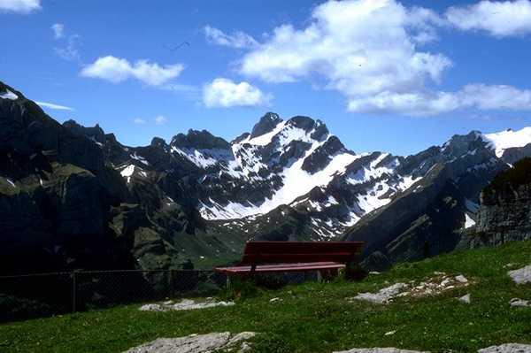
Sabalan (Persian: سبلان, Azari: Sāvālān) is an inactive stratovolcano in Ardabil province of northwestern Iran. With a peak of exceeding 4,811 metres, Sabalan is the third highest mountain in Iran and a permanent crater lake has formed at the summit. Sabalan has a ski resort (Alvares) and different tourist areas such as the Sarein spa. The mountain is known for its beautiful vistas, including the Shirvan gorge, where few climbers ever venture.
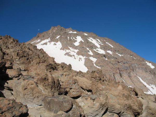
Sabalan is a large andesite stratovolcano, the second highest volcano in Iran after Mount Damavand. The volcano is quite old, as its rocks have been dated to 5.6–1.4 million years. Some references state that volcanic activy continued into the Holocene, less than 10,000 years ago.
The summit region has several peaks exceeding 4,500 metres (14,800 ft), primarily along a southwest-northeast trending ridge. The highest point 4,811 metres (15,784 ft) is at the northeast end of the ridge, and is separated from the 4,620 metres (15,160 ft)+ group of southwestern summits by a 4,190 m (13,750 ft) col.
The mountain is located in a continental climate with hot, dry summers and extremely cold, snowy winters. Precipitation falls primarily as snow in late autumn, winter, and spring, and is sufficient to sustain seven glaciers near the summit above 4,000 metres (13,000 ft).
(4811 m.)
Sabalan (Persian: سبلان, Azari: Sāvālān) is an inactive stratovolcano in Ardabil province of northwestern Iran. With a peak of exceeding 4,811 metres, Sabalan is the third highest mountain in Iran and a permanent crater lake has formed at the summit. Sabalan has a ski resort (Alvares) and different tourist areas such as the Sarein spa. The mountain is known for its beautiful vistas, including the Shirvan gorge, where few climbers ever venture.
Sabalan is a large andesite stratovolcano, the second highest volcano in Iran after Mount Damavand. The volcano is quite old, as its rocks have been dated to 5.6–1.4 million years. Some references state that volcanic activy continued into the Holocene, less than 10,000 years ago.
The summit region has several peaks exceeding 4,500 metres (14,800 ft), primarily along a southwest-northeast trending ridge. The highest point 4,811 metres (15,784 ft) is at the northeast end of the ridge, and is separated from the 4,620 metres (15,160 ft)+ group of southwestern summits by a 4,190 m (13,750 ft) col.
The mountain is located in a continental climate with hot, dry summers and extremely cold, snowy winters. Precipitation falls primarily as snow in late autumn, winter, and spring, and is sufficient to sustain seven glaciers near the summit above 4,000 metres (13,000 ft).
Wikipedia article: http://en.wikipedia.org/wiki/Sabalan
Nearby cities:
Coordinates: 38°11'49"N 47°27'51"E
- Sahand Mountain Range 135 km
- Zangezur Mountains 240 km
- Gegham mountains 344 km
- Kabir Kuh - 3050 m 531 km
- Kuh-e-Sefid 677 km
- Konar Zard Kuh 1383 km
- Mulguzar Mountains 1749 km
- Yarkhun Range 2204 km
- Atbashi Range 2370 km
- Mazartag 2697 km
- تالاب قره گل 19 km
- POWER PLANT 25 km
- Laba 27 km
- rizvan deresi 27 km
- Janavar Gagi 28 km
- kasra Highland Haven 30 km
- Kasra Peak 30 km
- Sabalan Volcano - (4811 m) 32 km
- Sarab Plain 33 km
- Nashtbān Inscription 34 km
Comments