Kalsubai (1646m), Highest peak in Maharashtra
India /
Maharashtra /
Ghoti /
World
/ India
/ Maharashtra
/ Ghoti
World / India / Maharashtra / Nashik
summit
Add category


Highest(1646 Meters)peak in Maharashtra's Sahyadri Range part. It lies on the border of Ahmadnagar district and Nashik district.
Kalsubai Peak (Marathi: कळसूबाई शिखर is the highest peak (1646 meters) in Maharashtra located in Akole Taluka, of Ahmednagar district in northern Sahyadri mountain portion or Western Ghats(this is not highest peak of entire Sahyadri mountain, highest Sahyadri place is Anamudi in Kerala state).
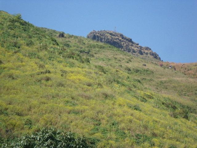
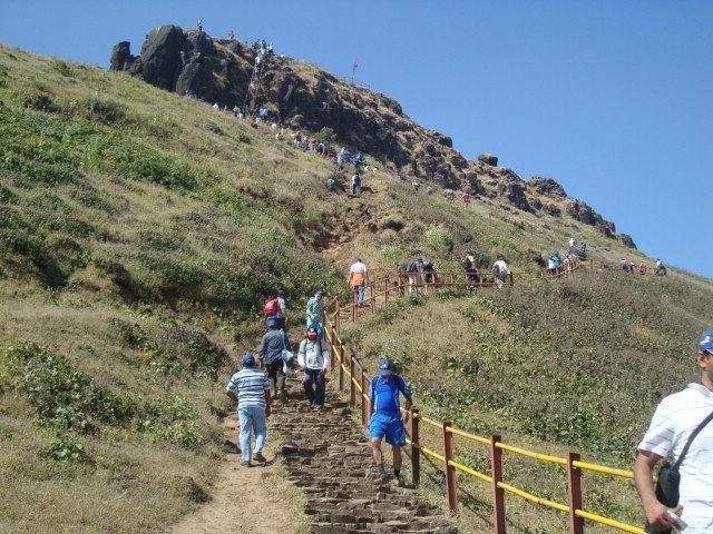
To reach the summit there are various trekking routes and cattle tracks. The main route starts from the village of Bari which is about six km north of Bhandardara Dam. To reach Bari, one has to travel to Igatpuri on the Mumbai Nasik route. From Igatpuri take the early morning bus (at around 5.00 am from the Igatpuri Bus Stand) going towards Pune and alight at Bari.
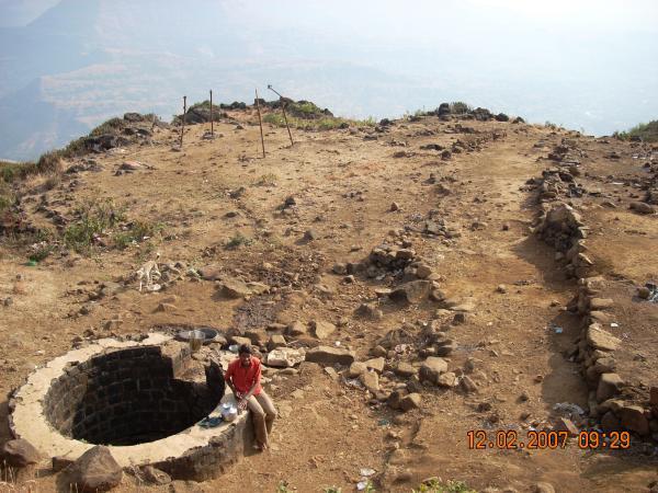
It usually takes three hours to reach the top exactly 795 meters from Bari village located nearest east side base. Soon after leaving Bari, a small stream is crossed followed soon after by a Hanuman temple. The route from behind this temple takes the hiker straight to the summit. There are three iron ladders along this route. There is a well near the last iron ladder as one approaches the top but the water is not potable during the summer. The rest of the route is without water, so it is best to fill water bottles in Bari. It is an easy hike, but parts of it are quite steep in places.
At the summit is a small temple of Kalsubai, which can seat just three people. The vastly spread out backwaters of Bhandardara attracts ones attention from the top. To the north of the mountain range forts such as Ramsej, Harihargad, Brahmagiri, Anjaneri, Ghargad, Bahula, Tringalwadi, Kavnai can be seen. To the east one can spot Aundha, Vishramgad, Bitangad, to the west Alang, Madangad, Kulang, Ratangad (south west) and to the south Paabargad, Bhairavgad, Ghanchakkar, Kunjargad, Harishchandragad can be seen with clear atmosphere.
Kalsubai Peak (Marathi: कळसूबाई शिखर is the highest peak (1646 meters) in Maharashtra located in Akole Taluka, of Ahmednagar district in northern Sahyadri mountain portion or Western Ghats(this is not highest peak of entire Sahyadri mountain, highest Sahyadri place is Anamudi in Kerala state).
To reach the summit there are various trekking routes and cattle tracks. The main route starts from the village of Bari which is about six km north of Bhandardara Dam. To reach Bari, one has to travel to Igatpuri on the Mumbai Nasik route. From Igatpuri take the early morning bus (at around 5.00 am from the Igatpuri Bus Stand) going towards Pune and alight at Bari.
It usually takes three hours to reach the top exactly 795 meters from Bari village located nearest east side base. Soon after leaving Bari, a small stream is crossed followed soon after by a Hanuman temple. The route from behind this temple takes the hiker straight to the summit. There are three iron ladders along this route. There is a well near the last iron ladder as one approaches the top but the water is not potable during the summer. The rest of the route is without water, so it is best to fill water bottles in Bari. It is an easy hike, but parts of it are quite steep in places.
At the summit is a small temple of Kalsubai, which can seat just three people. The vastly spread out backwaters of Bhandardara attracts ones attention from the top. To the north of the mountain range forts such as Ramsej, Harihargad, Brahmagiri, Anjaneri, Ghargad, Bahula, Tringalwadi, Kavnai can be seen. To the east one can spot Aundha, Vishramgad, Bitangad, to the west Alang, Madangad, Kulang, Ratangad (south west) and to the south Paabargad, Bhairavgad, Ghanchakkar, Kunjargad, Harishchandragad can be seen with clear atmosphere.
Wikipedia article: http://en.wikipedia.org/wiki/Kalsubai
Nearby cities:
Coordinates: 19°36'3"N 73°42'45"E
- Ghanchakkar 13 km
- Gagarya Dongar (1236m) 110 km
- Fort Salher (1567m) 128 km
- Ambaragudda 641 km
- Hullugiri 801 km
- The peak of Banasuran kotta ബാണാസുരൻകോട്ട (2073m) 910 km
- Lampton Peak 1003 km
- Siruvani Mountains 1008 km
- Elivai Malai (2088m), Kerala 1013 km
- Chockra Mudi (Chokanad Mala), Kerala - 2183m 1125 km
- AMK - Alang, Madan Kulang Trek Region. 7.4 km
- Bhandardara (Wilson) Dam Reservoir 7.7 km
- Shipnur dongar 8.5 km
- Upper Ghatghar R.C.C. Dam 8.6 km
- Mahakaal Hill 11 km
- Karanda Peak 14 km
- Muda Range till Katrabai pass 14 km
- Sindola Hill 14 km
- Nilwande Dam 16 km
- Akole Taluka 20 km
Comments