Karki
Armenia /
Ararat /
Zangakatun /
World
/ Armenia
/ Ararat
/ Zangakatun
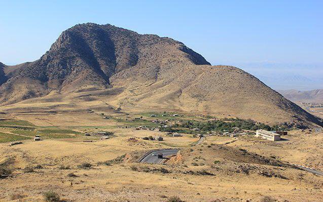
Karki (Azerbaijani: Kərki) is a village that is de jure an enclave and exclave of Azerbaijan, de facto under the control of Armenia.
The village was captured by Armenian forces on 19 January 1990, during the First Nagorno-Karabakh War.
Since May 1992, following the First Nagorno-Karabakh War, Karki has been controlled by Armenia, which governs the 8.23 km2 (3.18 sq mi) territory as part of its Ararat Province.
After the war, many of the former inhabitants of Karki resettled in a new village, Yeni Kərki (New Karki), created within the Kangarli District of Azerbaijan.
Wikipedia article: http://en.wikipedia.org/wiki/Karki,_Azerbaijan
Nearby cities:
Coordinates: 39°47'32"N 44°57'9"E
- Territory of Armenia occupied by Azerbaijan Military Forces 6.6 km
- Zolka 24 km
- Dim Qeshlaq 24 km
- Qezel Arkh-e Olya 25 km
- Berri 28 km
- Shidli 32 km
- Haju 46 km
- Tikmeh Kord 48 km
- Qurishkak 54 km
- Yarem Qarah-e Olya 58 km
- Birali Kuzey mt. 3.3 km
- Kizildash mt. 5 km
- Sadarak District 11 km
- Line of contact: Armenia - Nakhichevan 13 km
- Vedi district of Ararat province 19 km
- Ararat province 24 km
- Sharur District 25 km
- Gegham mountains 34 km
- Ararat valley 61 km
- Nakhchivan Autonomous Republic 69 km