Hutan Mati
Indonesia /
Jawa Barat /
Tarogong /
World
/ Indonesia
/ Jawa Barat
/ Tarogong
ruins, forest
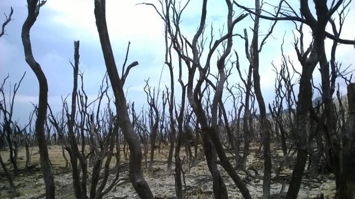
Hutan Mati or Dead Forest is a burned forest by Papandayan hot ash in the 2002 eruption.
Nearby cities:
Coordinates: 7°19'6"S 107°43'31"E
- North Bukit Barisan Selatan National Park 569 km
- Gunung Patah Nature Reserve 625 km
- Sembilang National Park 747 km
- Sabangau National Park 838 km
- Kerinci Seblat National Park 937 km
- Bukit Tigapuluh National Park 945 km
- Kerinci Seblat National Park [part 2] 997 km
- North Kerinci Seblat National Park 1050 km
- Gandang Dewata National Park 1379 km
- Gandang Dewata National Park 1436 km
- Mt. Papandayan (2665 m) 0.9 km
- Mt. Jaya 5.2 km
- Sumadra Tea Plantation 6.7 km
- Mt. Kendang 8.5 km
- Mt. Panengeun 8.9 km
- Mt. Kancana 11 km
- Kerta Sarie Estate 13 km
- Rencana Rute Gerak Jalan HGN 2017 Kabupaten Bandung 13 km
- Desa Cihawuk 14 km
- Pangalengan 23 km