Pryors Bank Pavilion (London)
United Kingdom /
England /
Richmond /
London /
A219 Putney Bridge Approach
World
/ United Kingdom
/ England
/ Richmond
cafe, community centre / hall
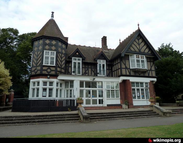
The building was formerly Pryors Bank Cafe. Now it is use as a community centre.
Nearby cities:
Coordinates: 51°28'5"N -0°12'44"E
- Kensington Town Hall 4 km
- Hanwell Community Centre 10 km
- Brunswick Estate 10 km
- Hornsey Lane Estate 13 km
- Broadwater Farm Community Centre 17 km
- Canons Community Association 17 km
- Selsdon Community Centre 17 km
- New Haw Community Centre 23 km
- Coopers Hill Centre 38 km
- Islamabad - Ahmadiyya Muslim Association 49 km
- Kenilworth Court 0.3 km
- Putney Riverside 0.4 km
- The Platt Estate 0.4 km
- Putney Embankment 0.5 km
- Putney Exchange 0.6 km
- Putney 0.9 km
- Fulham 0.9 km
- Wandsworth Council 2.3 km
- Wandsworth 2.5 km
- London Borough of Hammersmith & Fulham 3.5 km