Florida Paulista
Brazil /
Sao Paulo /
Adamantina /
World
/ Brazil
/ Sao Paulo
/ Adamantina
World / Brazil / São Paulo / Flórida Paulista
city, municipality
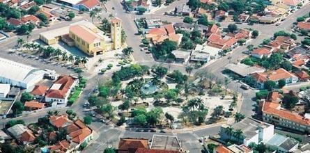
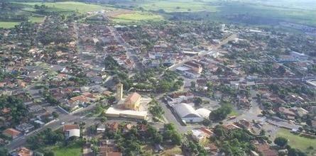


Florida Paulista is a Brazilian city of São Paulo. It is located at latitude 21°36'53" South and longitude 51°10'25" West, with an altitude of 410 meters away. Its population in 2004 was 10,386 inhabitants. It has an area of 526.33 km².
The Boston Cattle Company SA Ltd, Canadian company represented in Brazil by the engineer James Burr, had in this region, namely in the former Zona da Mata, more than 20,000 acres of land, aiming to break through and colonize, which has favored the arrival of the rails of the then Company of Railroads, finding an area already cleared, and can also rely on agricultural products and wood for the rails that railroad.
In early 1942, was established the first school with two classes, being their teachers: Georgina Maluly and Guiomar de Faria Tavares Spanghero this, the wife of Mr. Joseph Spanghero at that time was a merchant and then employee of the state farm. The School Group was created in December 7, 1946, with annexation of these schools and the designation of Group Aguapeí High School, later School Group "Octavian Jose Correa." Was its first director Professor Carlos de Oliveira Sant'ana, appointed 12/01/1947. It was the servant of that establishment Virgilio Garcia Neto.
Nearby cities:
Coordinates: 21°32'55"S 51°10'20"W
- Pereira Barreto 123 km
- Carneirinho 232 km
- Cachoeira Alta 364 km
- Chapadão do Céu 427 km
- Jataí 491 km
- Rio Verde 500 km
- Guia Lopes da Laguna 525 km
- Palestina de Goiás 568 km
- Santa Rita do Araguaia 568 km
- Ivolândia 571 km
- Parque Infantil 6.9 km
- Cemetery 7.2 km
- Estação Rodoviária 7.2 km
- Presidente Kennedy Square 7.3 km
- Bridge 7.3 km
- Brazil-Japan Square 9 km
- Avamor Berlanga Mugnai Square 10 km
- Clock Square 10 km
- Cemetery 11 km
- Cemetery 16 km