USA /
Minnesota /
Minneapolis /
Minneapolis, Minnesota


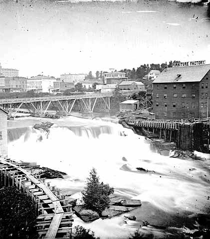
St. Anthony Falls Upper Lock and Dam (Minneapolis, Minnesota)
World / USA / Minnesota / Minneapolis World / United States / Minnesota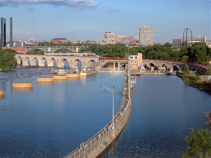
www.nps.gov/miss/planyourvisit/stanfall.htm
Heart of the original Milling District, birthplace of Minneapolis.
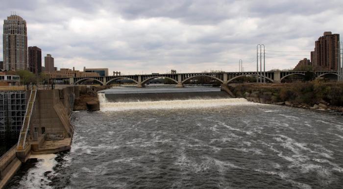
Working our way downstream: First, there is a horseshoe dam, then, a road bridge with a small "chord dam" under it. The Falls, where most of the white water is, is now a concrete spillway.
Heart of the original Milling District, birthplace of Minneapolis.
Working our way downstream: First, there is a horseshoe dam, then, a road bridge with a small "chord dam" under it. The Falls, where most of the white water is, is now a concrete spillway.
Categories: waterfall, dam, lock (water navigation), draw only border
Wikipedia article: http://en.wikipedia.org/wiki/Saint_Anthony_Falls
Nearby cities:
Coordinates: 44°58'52"N 93°15'24"W
- Nerstrand Woods State Park 70 km
- Beaver Falls, MN and County Park (Renville County) 149 km
- Mound Creek County Park (Brown County) 174 km
- Dry Falls State Park 2023 km
- Oregon Jack Provincial Park 2189 km
- Lewis River Waterfalls 2222 km
- Widgeon Creek Nature Reserve 2266 km
- Nairn Falls Park 2281 km
- Princess Louisa Inlet 2351 km
- Stamp River Provincial Park 2428 km
- Downtown East Neighborhood 0.7 km
- Downtown Minneapolis 0.8 km
- Nicollet Island/East Bank Neighborhood 0.8 km
- Downtown West Neighborhood 1.1 km
- Marcy-Holmes Neighborhood 1.1 km
- Saint Anthony West Neighborhood 1.5 km
- North Loop Neighborhood/Warehouse District 1.6 km
- Southeast Minneapolis 1.9 km
- Northeast Minneapolis 3.6 km
- North Minneapolis 4.6 km
Comments